Back To Home
The Story Behind the Weather - By Forecaster John
Ensworth M.S. -
The Discussion of Weather Events Daily for Philadelphia and Pennsylvania
Last updated: 09/14/2003 02:30 PM
Good Morning Philadelphia!
I'm back, and, without further a due, here we go...
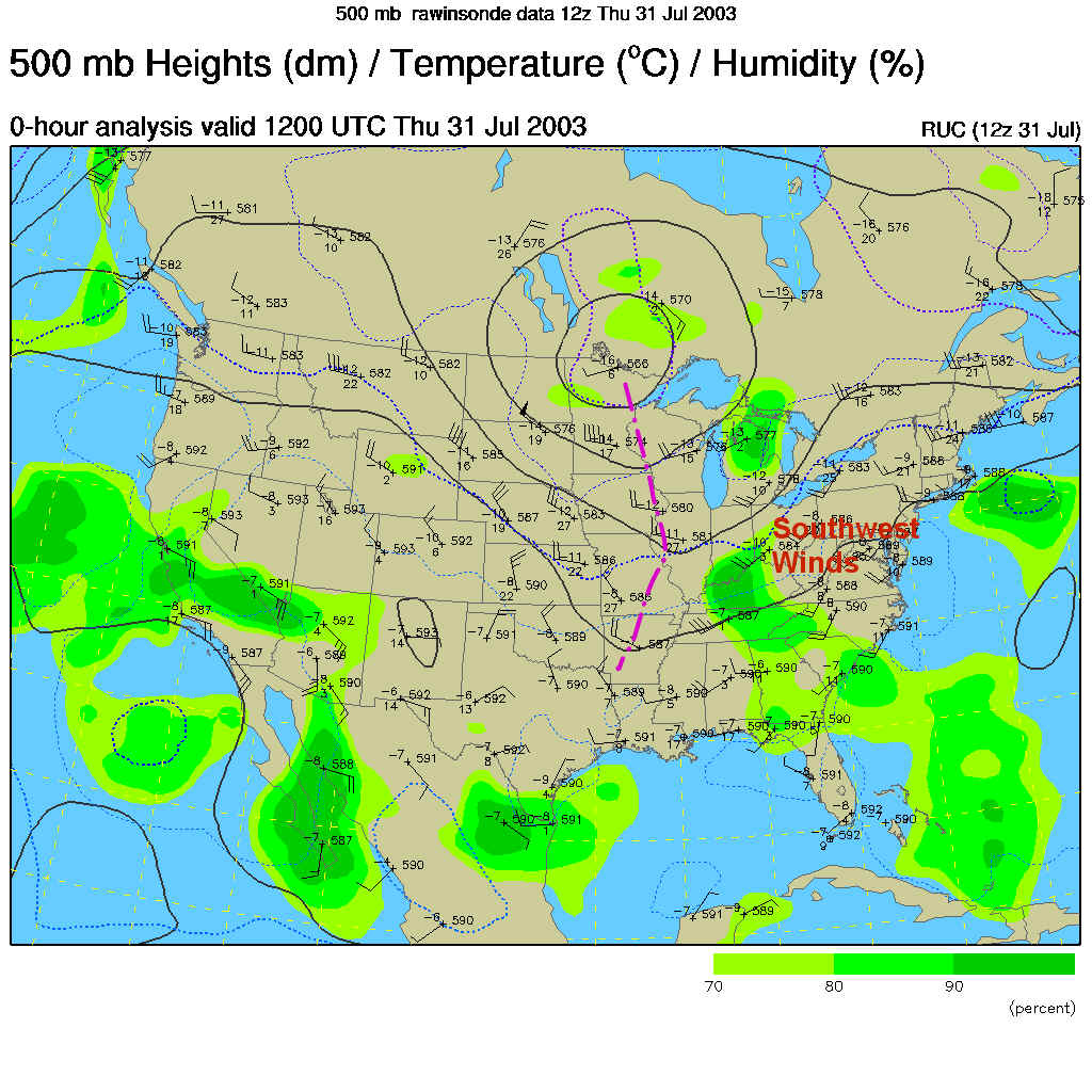
The front that set up south of us is still there. It has had rain and showers traveling down it for the last 3-4 days. As long as it stays down there, we remain mostly rain free. But it is coming back! The Low pressure system deepening on the front in southern Illinois (circled in purple) is a ripple that is forming in response to the deepening 500mb trough in the central eastern US. You can pop down to the 500mb map here. I've marked that trough in in the same color purple. As that moves east we'll see the showers approaching. But I get ahead of myself. Let's look at the current conditions first...
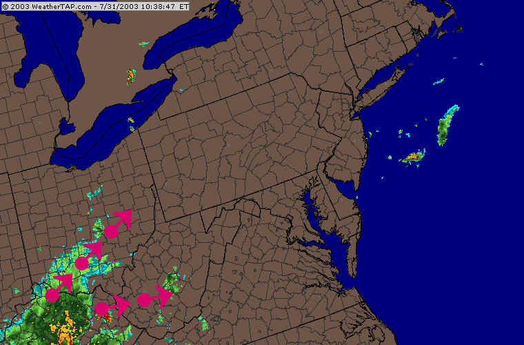
One ripple along the front caused just a few showers to brush Philadelphia over the last day. This image is the precipitation totals from the Doppler Radar system. The heavier rainfall stayed to our west (up to an inch or so in a small area). We only got sprinkles over the metro area.
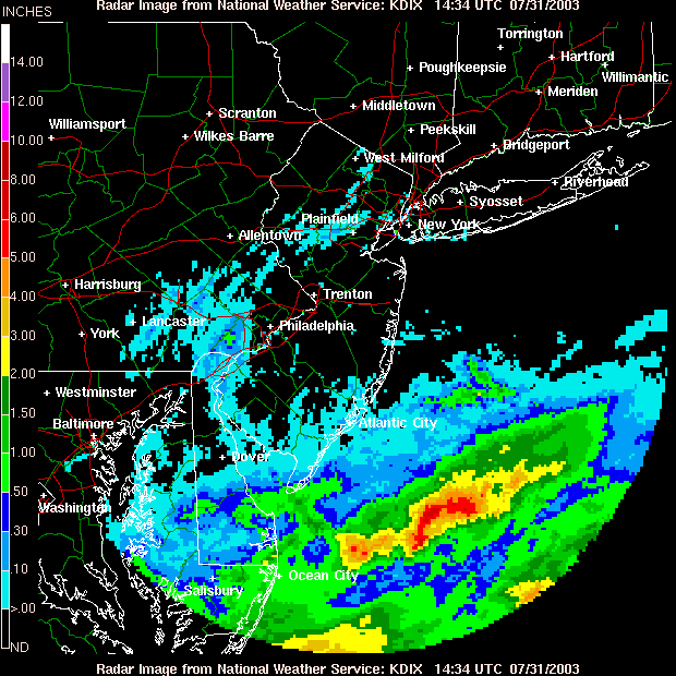
The rainfall associated with the deepening surface low and the approaching upper level trough can be seen in this morning's radar image. The echoes are expanding and moving toward us slowly.
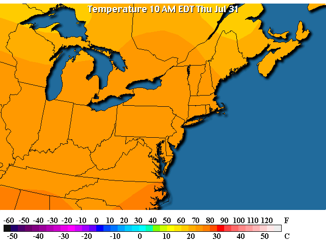
Before the front returns and passes us again, we are still in relatively mild air. Temperatures this morning are in the 70's...
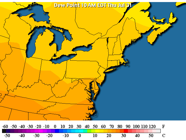
And dew points (a statement of how much water vapor there is in the atmosphere; this is the temperature you need to cool the air down to to get 100% relative humidity. The lower the number, the more you have to cool the air, so the drier it is) are relatively low (in the 50's). This makes even a warm day feel pleasant.
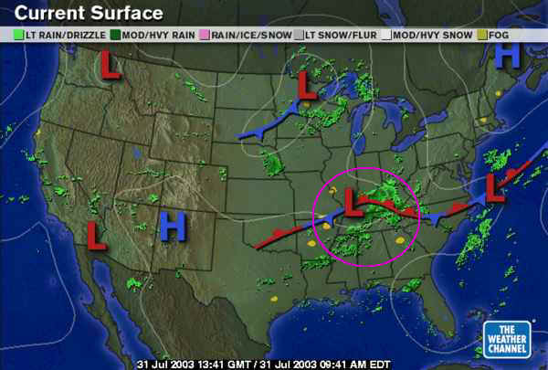
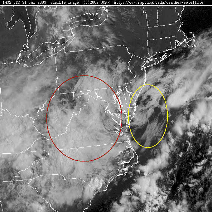
But the changes are coming. The satellite picture shows that cloudiness is on the increase from the southwest. North of this front, we do have east winds which is bringing in cooler ocean air. On the visible satellite loop (see the link below today) you can see that the clouds circled in yellow are moving out of the east while the higher clouds (circled in red) are moving out of the west. This is a pattern we often see late in the summer and early fall. It keeps us moist and cool (with drizzle and such being quite common).
The Visible Satellite Loop for today is available here. This is only viewable on 7/31/2003 (it is live data and will not match the discussion after sunset on this day). http://www.rap.ucar.edu/weather/satellite/displaySat.php?region=BWI&isingle=mult_big&itype=vis
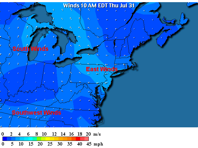
The surface winds are, indeed, out of the east today. The southwest and south winds to our southwest and west are the bringers of heat and humidity soon. Brace yourself!
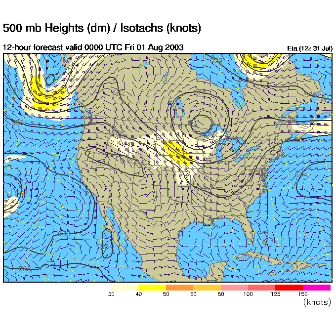
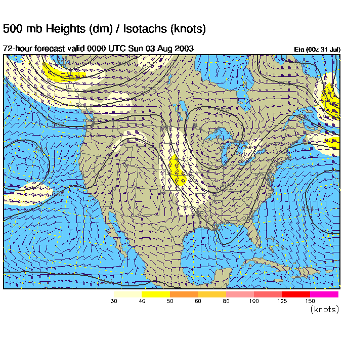
The 500mb map below shows how winds are moving across the nation at about 18,000 feet. The winds at this height are thought of as the 'steering' winds for most thunderstorms and low pressure systems. You can see it is these winds that are responsible for the higher clouds on the visible satellite picture above moving to the northeast.
(And you can see the trough out to our west that is approaching and will bring us days of rain and warm humid weather soon.)
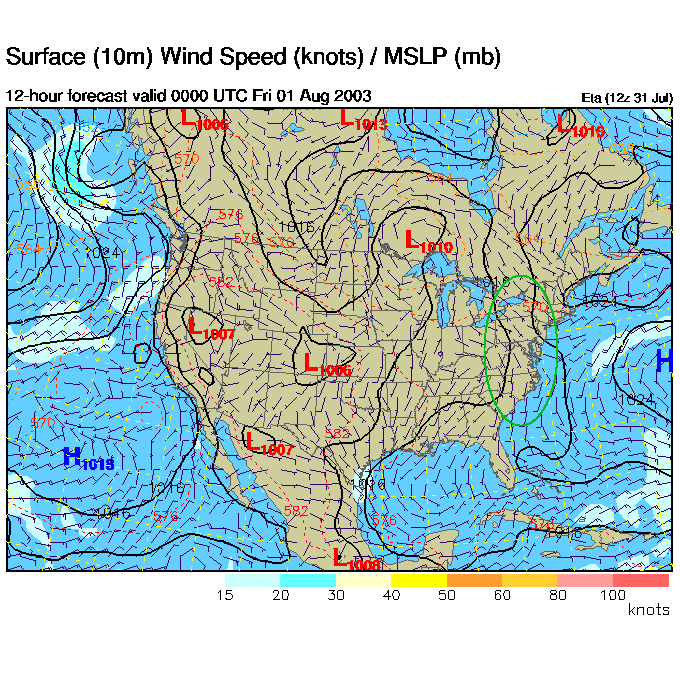
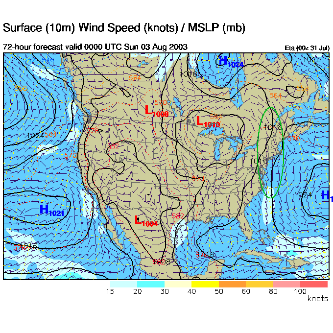
What is about to happen is, basically, the east coast is going to be squeezed between the big high pressure system out in the south central Atlantic (called the Bermuda High) and the Low to our west then northwest. Everything is going to come to a screeching halt soon and we'll be caught under the front and the lift side of the upper level trough (the right side of the trough is where clouds and rain forms easiest).
So the 500mb pattern Thursday night looks like such. The big trough is sitting to our west.
At the same time, there is elongated Low pressure from the western Great Lakes down to the Oklahoma panhandle. The High pressure system to our southeast is visible at the edge of the frame. The squeeze zone is setting up in the green circled area.
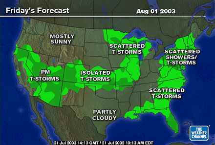
And rain showers start to break out all over.
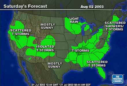
Saturday shows east winds still bringing moisture in over us off the ocean, and more showers forming to our southwest heading northeast towards our state...
By Saturday night the trough to our west is deeper (and the high to the southeast is stronger). The squeeze is getting stronger!
The Low in the lakes is more circular and has expanded a bit towards us. The high to the southwest is more dominate. The isobars (lines of equal pressure) over us are tighter in the green circled area. This will bring us relatively strong south winds.
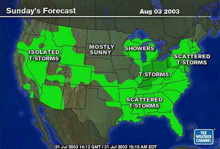
Sunday and we have more showers...
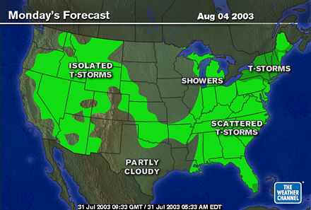
Monday and more showers...
Tuesday, stronger storms and showers.
So say goodbye to prolonged sun exposure and hello to on and off again showers. I'll be back here tomorrow for more details...
Until then, keep looking up!
Meteorologist John Ensworth
Surface Station sky cover color key:
Flight category definitions:| Category | Ceiling | Visibility | |
|---|---|---|---|
| Low Instrument Flight Rules LIFR* (magenta circle) |
below 500 feet AGL | and/or | less than 1 mile |
| Instrument Flight Rules IFR (red circle) |
500 to below 1,000 feet AGL | and/or | 1 mile to less than 3 miles |
| Marginal Visual Flight Rules MVFR (blue circle) |
1,000 to 3,000 feet AGL | and/or | 3 to 5 miles |
| Visual Flight Rules VFR+ (green circle) |
greater than 3,000 feet AGL | and | greater than 5 miles |
| *By definition, IFR is ceiling less than 1,000 feet
AGL and/or visibility less than 3 miles while LIFR
is a sub-category of IFR. +By definition, VFR is ceiling greater than or equal to 1,000 feet AGL and visibility greater than or equal to 3 miles while MVFR is a sub-category of VFR. |
|||