Back To Home
The Story Behind the Weather - By Forecaster John
Ensworth M.S. -
The Discussion of Weather Events Daily for Philadelphia and Pennsylvania
Last updated: 09/14/2003 02:31 PM
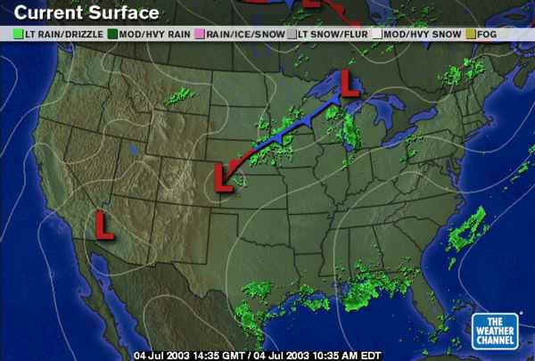
Happy 4th of July! It looks like there won't be much of a threat of a shower this evening, but there will be a few, widely spaced storms in the southeastern part of the state that might mess up someone's fireworks. As you can see in the surface map below, there are no real reason for showers (the nearest front is still in the northern plains) and the remains of T.S. Bill is moving further out to sea.
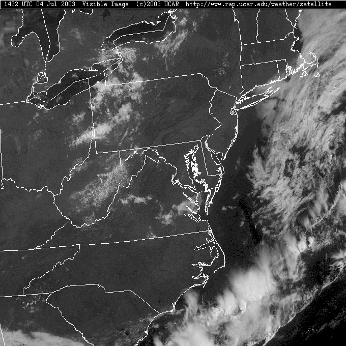
The visible satellite picture shows shocking clear skies for the Philadelphia area and some bubbling cumulus out in the western part of the state. So is it as dry as it seems looking out the window or down from a satellite?
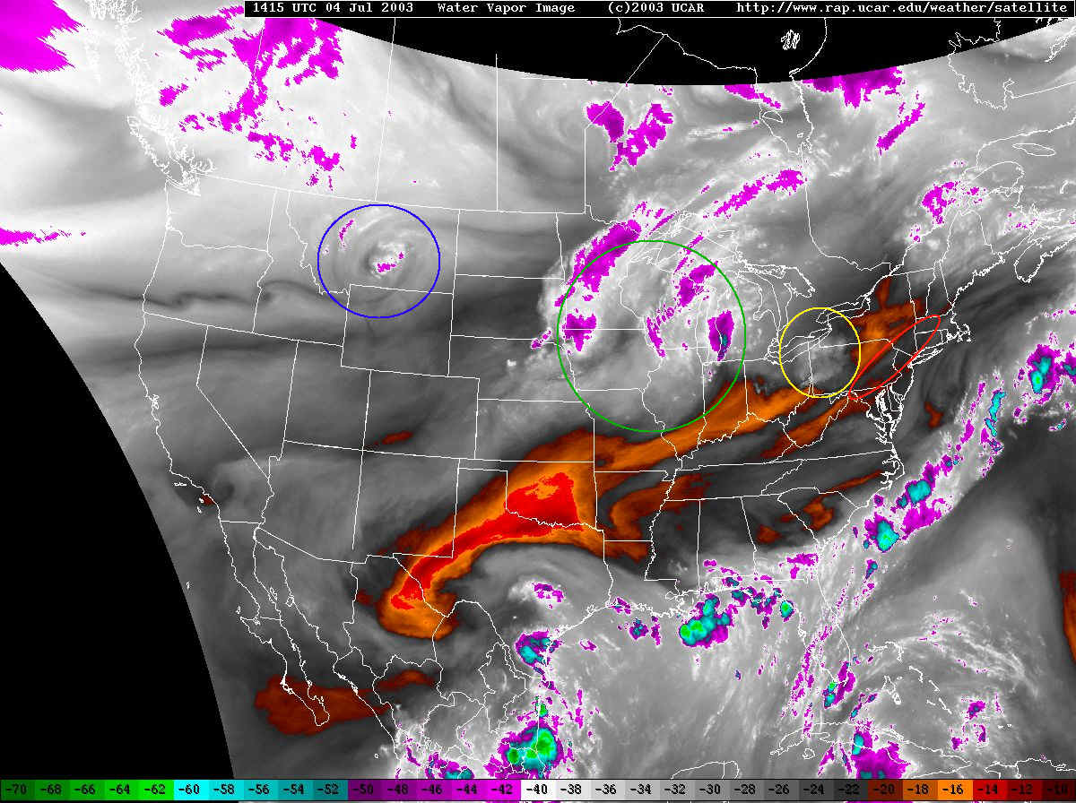
The water vapor satellite (that shows how much moisture there is in the middle of the atmosphere - whites to purples are quite moist, darker blacks to reds are quite dry... usually there is rising air where there is moisture, and sinking air where it is red) shows some neat features. The red circle (oval) shows where the last of the moisture from T.S. Bill is departing. While it is overhead this afternoon, we will still have a chance of storms once the sun heats the ground. The yellow circle shows some lift associated with the approaching system to our west (and the cumulus bubble out there). This is the fly in the ointment that could invalidate this afternoon's forecast. If it has much colder temperatures than we have measured by our infrequent, sparse upper air network, then more significant showers could kick off.
The green circle shows the next system that will effect our area Saturday night into Sunday morning (and again Sunday night), and further out in the northern Rockies (in the blue circle) is a swirl that has our name on it for Monday into Tuesday. With the jest stream just to our north, systems keep tracking near us as summer heat and moisture begin to flow into our state. We have the clash of air masses in our neighborhood for this time.
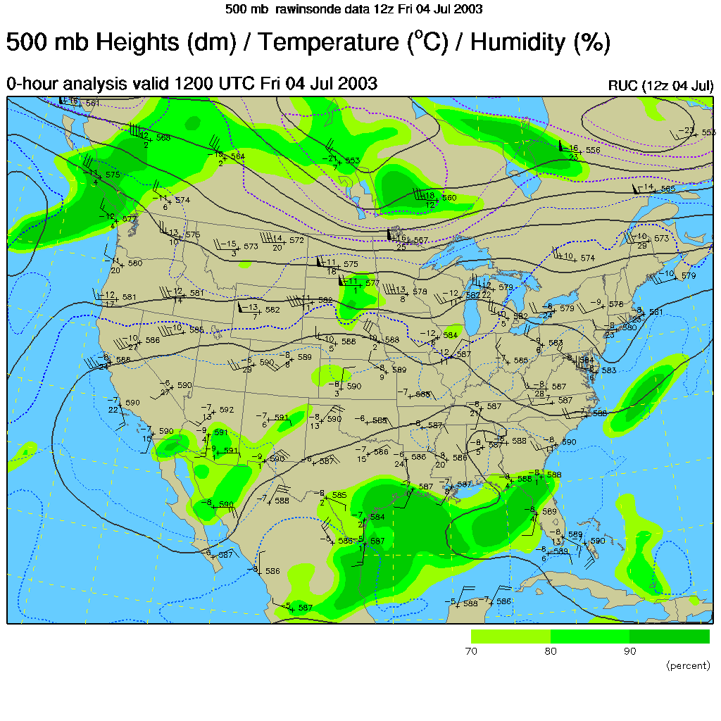
The winds at approximately the same level as is shown in the picture above are shown in the 500mb level map (this is the winds at the 1/2 way up pressurewise level in the atmosphere, about 18,000 feet). They blow from left to right parallel to the dark lines drawn in. The tightest lines on this map shows the approximate location of the jet stream. The jet steam moves storm systems along (being it is the boundary between cold air to the north and warm air to the south). The jet also helps make thunderstorms stronger by providing shear (different wind speeds or directions at different heights in the atmosphere) and pulling away the spent moisture and heat so the storm can continue to live (and get stronger).
With that wave approaching out of the lakes and the weak front ahead of it, we have a slight risk of severe weather over the northern half of Pennsylvania and at least a chance of something convecting over us today.
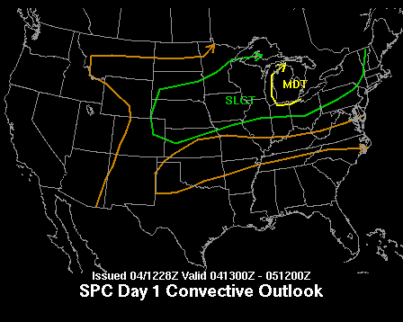
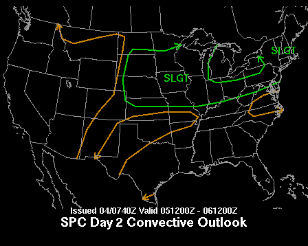
For Saturday, the system moves over us giving the rest of the state including Philadelphia a chance of thunder.
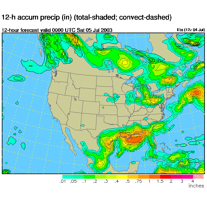
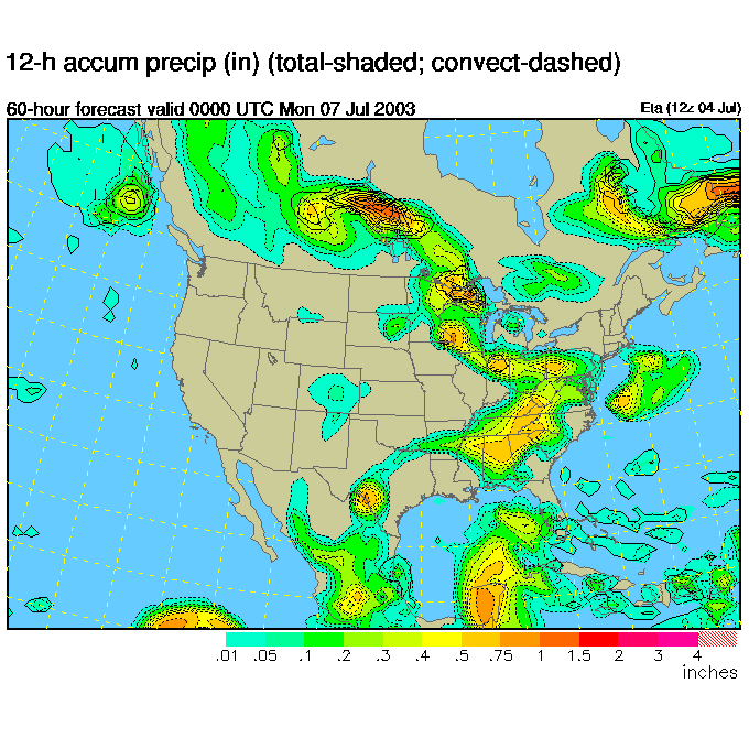
I've included, this morning, the frames of the ETA model showing the showers that it thinks will effect us. This first frame is for tonight (yikes!) with this graphic representing 6 hours either side of Friday 8pm. Western Pennsylvania gets the bulk of the showers, but the precipitation extends to us.
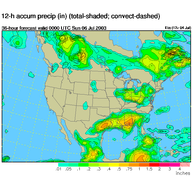
The next round of a fair chance for showers happens either side of Saturday night at 8pm.
Then larger scale forces come into play to from Sunday night onward where repeated chances of rain will hit.
So take an umbrella with you to the fireworks tonight ... you're now completely out of the woods, and if you're camping, keep the raingear and tarps ready for sporadic heavy rains. Most of the time it will not be raining, so don't cancel things. Just be prepared and have fun!
I'll see you again tomorrow.
Meteorologist John Ensworth
Surface Station sky cover color key:
Flight category definitions:| Category | Ceiling | Visibility | |
|---|---|---|---|
| Low Instrument Flight Rules LIFR* (magenta circle) |
below 500 feet AGL | and/or | less than 1 mile |
| Instrument Flight Rules IFR (red circle) |
500 to below 1,000 feet AGL | and/or | 1 mile to less than 3 miles |
| Marginal Visual Flight Rules MVFR (blue circle) |
1,000 to 3,000 feet AGL | and/or | 3 to 5 miles |
| Visual Flight Rules VFR+ (green circle) |
greater than 3,000 feet AGL | and | greater than 5 miles |
| *By definition, IFR is ceiling less than 1,000 feet
AGL and/or visibility less than 3 miles while LIFR
is a sub-category of IFR. +By definition, VFR is ceiling greater than or equal to 1,000 feet AGL and visibility greater than or equal to 3 miles while MVFR is a sub-category of VFR. |
|||