Back To Home
The Story Behind the Weather - By Forecaster John
Ensworth M.S. -
The Discussion of Weather Events Daily for Philadelphia and Pennsylvania
Last updated: 09/14/2003 02:31 PM
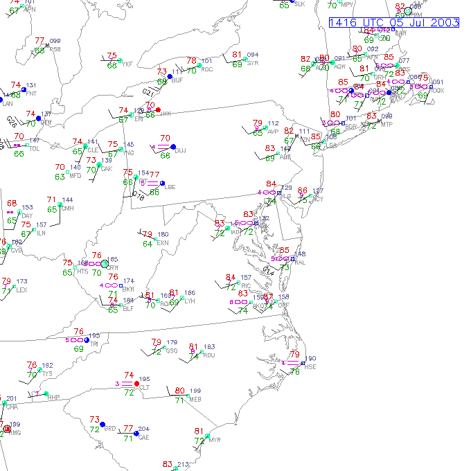
I hope you had a great 4th of July. The rain stayed quite spotty and happily to our west. The main story other than the pretty good chance of thunderstorms tonight across the southern part of the state (including Philadelphia), is the very typical heat and humidity. Temperatures at 10am are already warm and the humidity is high. We have 80's across the Philadelphia area (the red numbers) and dew points in the mid 70's (the green numbers which is VERY moist). Winds are pretty uniform out of the west at 10mph bringing hot continental air in over us.
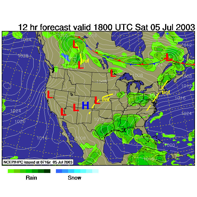
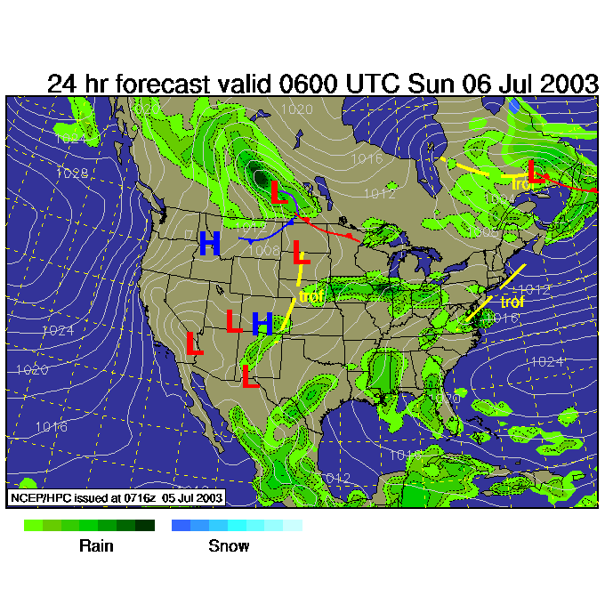
The rain tonight should be moving in from the west mainly around the dinner hour just to the west of the Philadelphia area, then moving in near sunset and beyond. The 12 hour forecast surface map shows the rain (heavier to the west) spreading in. Tonight will be wet most places except for the northern part of the state.
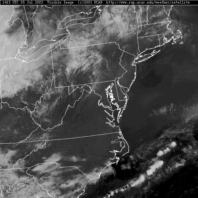
It is nice and clear, if hazy, around Philadelphia this morning, but the thick white clouds to the west are our future.
The blue colors below are the coldest cloud tops (reds are the warmest surfaces, i.e. ground most of the time). We are interested in the coldest clouds because that is most often where rain is happening. To check this, lets look at the radar image...
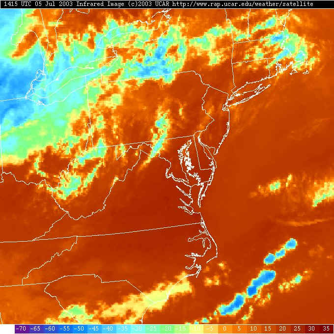
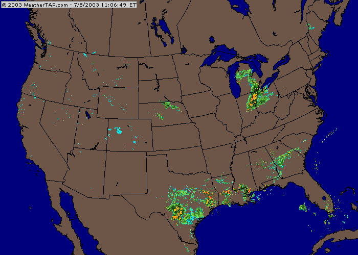
Sure enough, the blue colors above (and the whitest clouds on the visible satellite picture 2 up) are being caused by the thunderstorms that are arcing across Indiana, Ohio and Michigan. They are heading our way and will get a boost out of increased surface heating this afternoon and the high dew points around here (the water vapor in the atmosphere is the fuel for thunderstorms to strengthen).
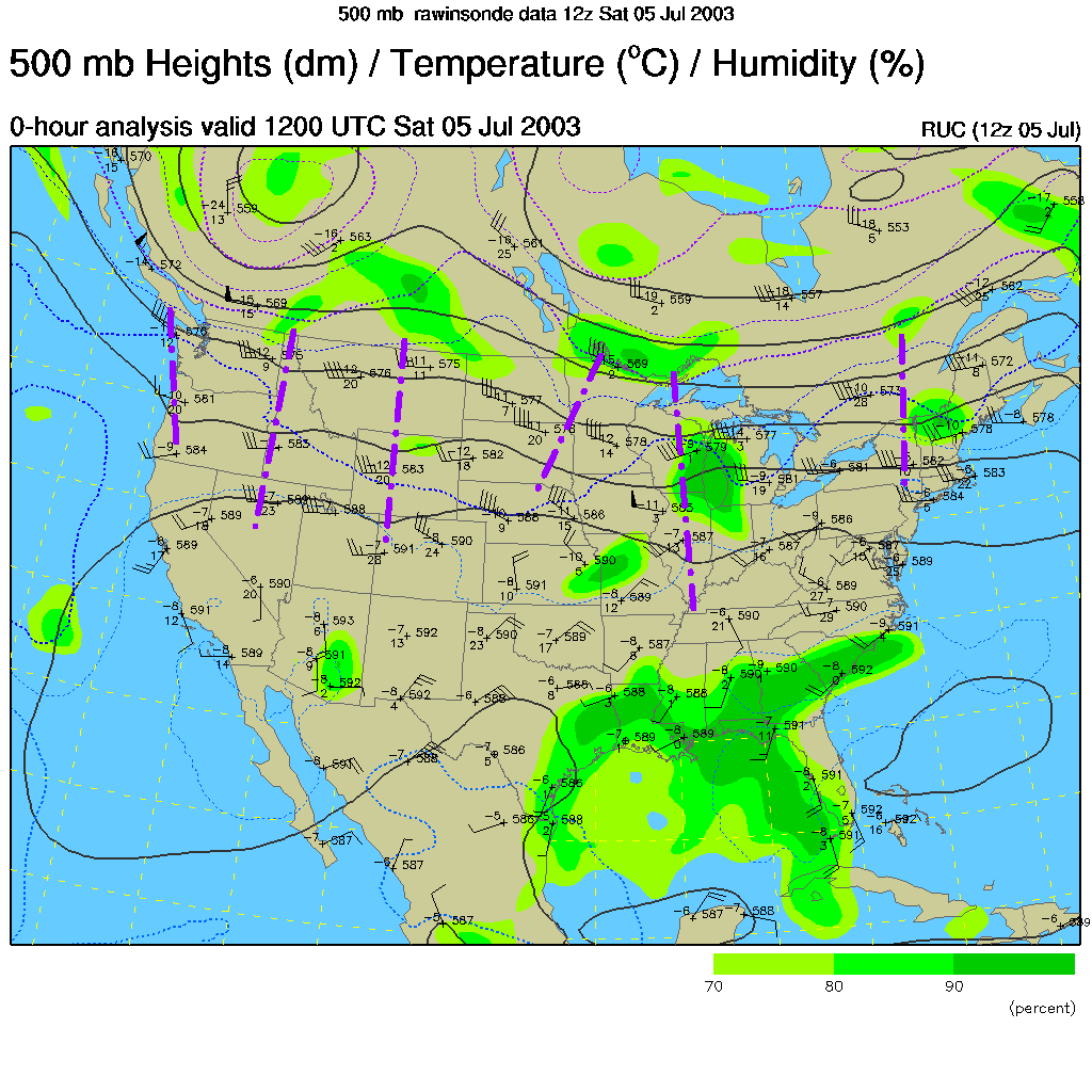
The main cause for rain chances we will be living with through Wednesday (since we don't have fronts passing every time it is raining) are bubbles of cool air in the upper atmosphere meteorologists call short waves. I've marked all the short waves and suggested short waves in the 500mb map below (these are the winds at the 1/2 point in the atmosphere (concerning pressure) - i.e. about 18,000 feet). The short waves are marked with purple dashes.
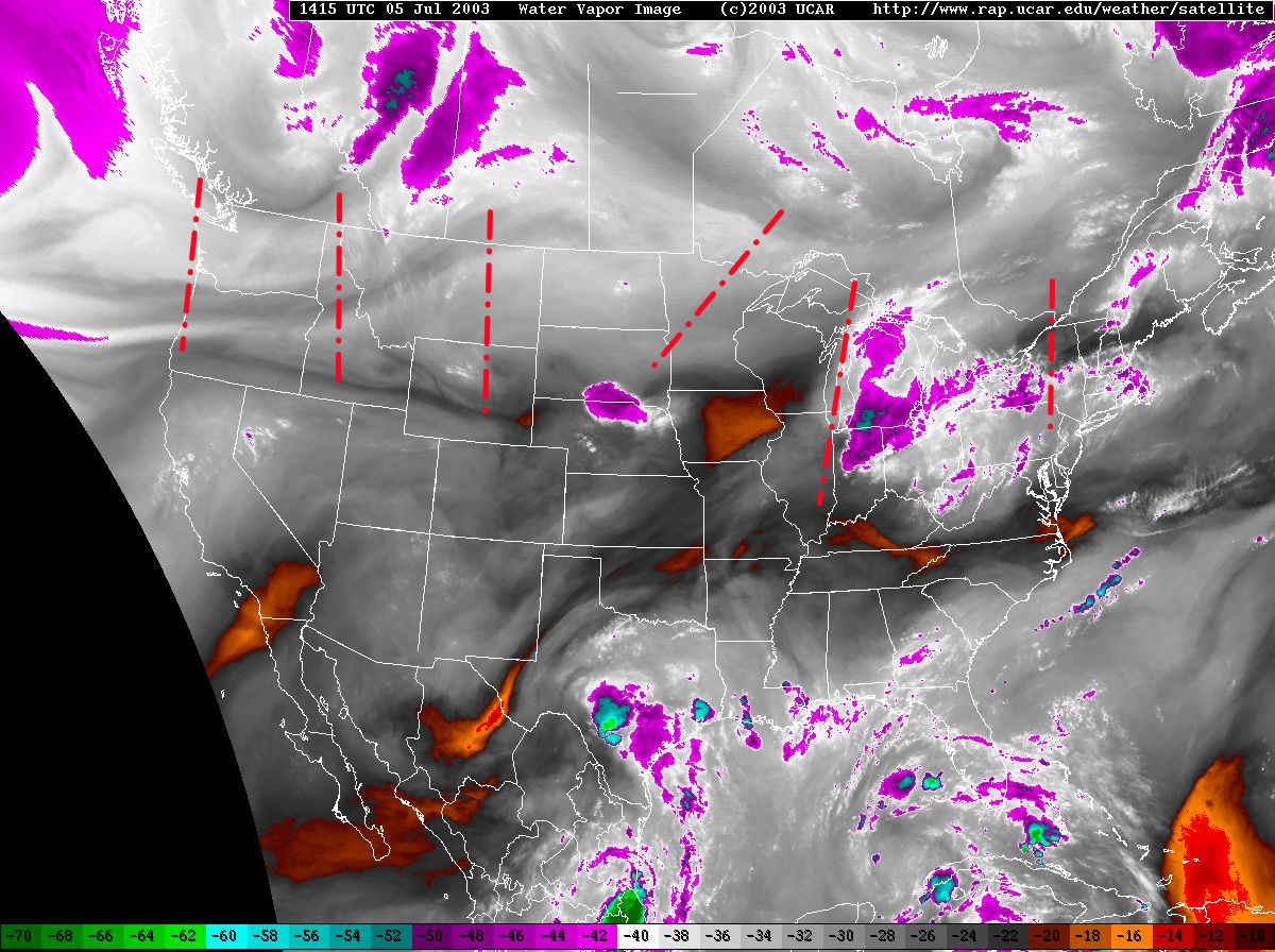
The water vapor satellite picture shows water vapor in the atmosphere at about the same place in the atmosphere as the map above shows winds. I've marked in the short waves in red. There is some hint for some of these short waves in this images. The eastern short waves all have convection or clouds associated with them, the ones out west are starved for moisture and don't yet have storms associated with them.
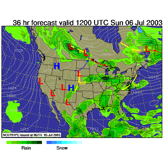
By Sunday morning 2am, we see showers west and south of the state, but nothing right here again.
Eastern Pennsylvania is still mostly in the dry by 8am Sunday (there is a chance of random showers popping up as a shortwave eases towards us).
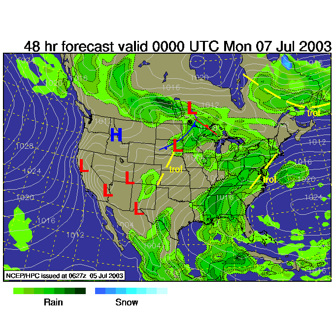
Then by Sunday night 8pm, there is a fairly good chance of showers state wide as another short wave passes over our warm moist air.
The next chance of showers will be around Wednesday. Monday and Tuesday look warm to hot and humid. Stay cool, enjoy your weekend and I'll see you again Monday...
Meteorologist John Ensworth
Surface Station sky cover color key:
Flight category definitions:| Category | Ceiling | Visibility | |
|---|---|---|---|
| Low Instrument Flight Rules LIFR* (magenta circle) |
below 500 feet AGL | and/or | less than 1 mile |
| Instrument Flight Rules IFR (red circle) |
500 to below 1,000 feet AGL | and/or | 1 mile to less than 3 miles |
| Marginal Visual Flight Rules MVFR (blue circle) |
1,000 to 3,000 feet AGL | and/or | 3 to 5 miles |
| Visual Flight Rules VFR+ (green circle) |
greater than 3,000 feet AGL | and | greater than 5 miles |
| *By definition, IFR is ceiling less than 1,000 feet
AGL and/or visibility less than 3 miles while LIFR
is a sub-category of IFR. +By definition, VFR is ceiling greater than or equal to 1,000 feet AGL and visibility greater than or equal to 3 miles while MVFR is a sub-category of VFR. |
|||