Back To Home
The Story Behind the Weather - By Forecaster John
Ensworth M.S. -
The Discussion of Weather Events Daily for Philadelphia and Pennsylvania
Last updated: 09/14/2003 02:34 PM
Good Morning Philadelphia!
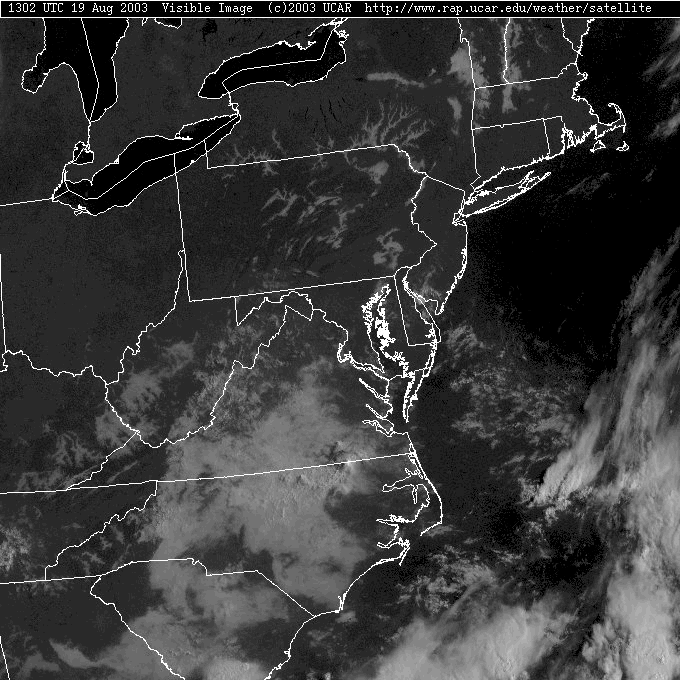
We have clear, cool, still dry great blue skies this morning. Wow.
The only clouds visible on the visible satellite picture are tendrils of fog in the canyons and low lying areas around the state. You can actually see the land formations in the fog below. Really neat.
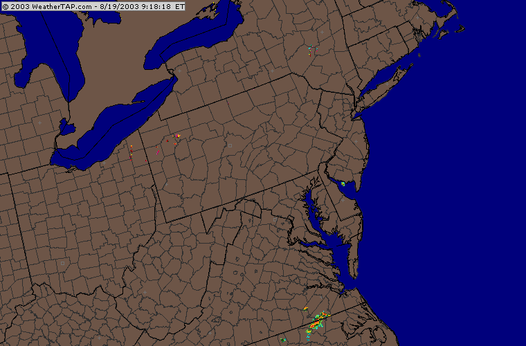
The radar is clear and clean...
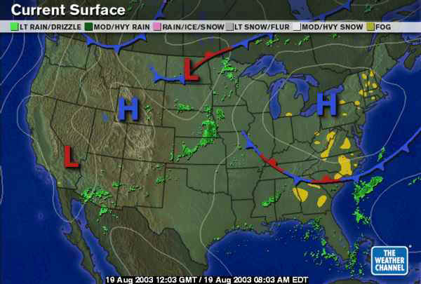
And the center of this front's trailing high pressure system is sliding right into Pennsylvania this morning. The air is sinking and clouds are hard pressed to form, let alone produce any precipitation.
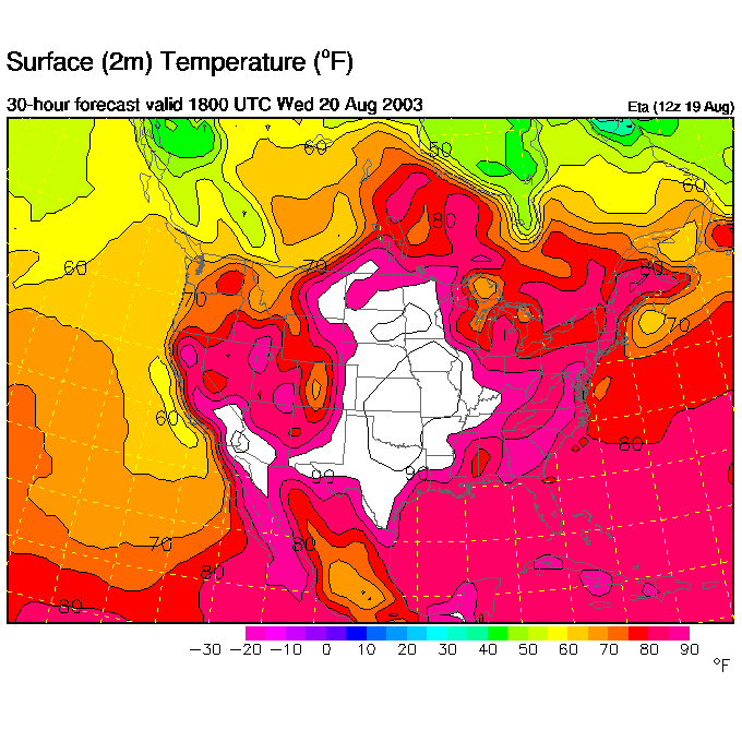
The story will be the building heat though. The afternoon temperatures today are expected to get into the upper 80's or lower 90's and will creep upward as the week goes on.
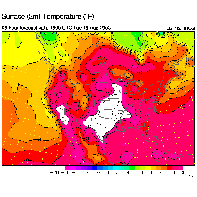
The temperatures are, for Wednesday afternoon, expected to solidly be in the 90's (at least we aren't having the 100's + the central plains are!).
The reason for this is the upper air pattern. Our cooling east coast trough is slowly sliding away and pulling northward and the "Big Ridge" is expanding towards us.
An interesting feature this morning is "Old East Coast Trough". Over the last (almost) two weeks this trough has been on an incredible journey. It was our trough two weeks ago when the central US ridge and the Bermuda High merged briefly. That pinched the trough in half and left a piece in the deep south. As is marked on the map in Green below, the center of that piece of cool upper level air has moved to the southwest. It brought a brief period of rain to many areas in Texas and New Mexico. It kicked off thunderstorms in Arizona and southern California, and is now heading northward again to remerge with the westerlies. Watch the forecast maps at the bottom of this discussion for it's future (dashed line) as it remerges with the east coast trough later this week.
Someone should write a book about this little trough that could.
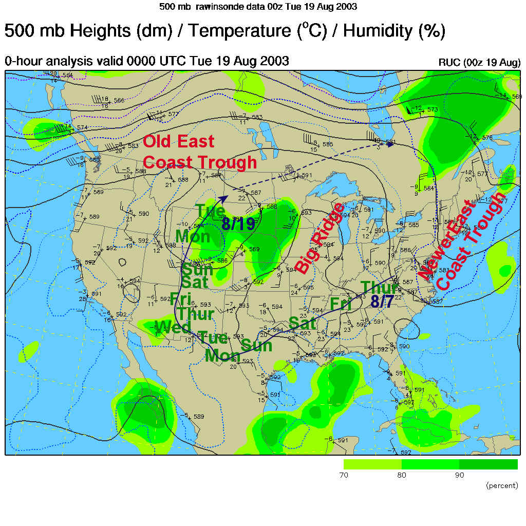
Wednesday morning's 500mb map shows the 18,000 foot level wind pattern as having a building east coast ridge heating us up. The newer east coast trough is further out east and weaker. The little-trough-that-could is in the northern plains.
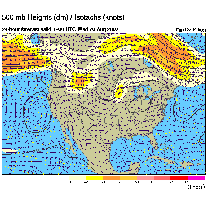
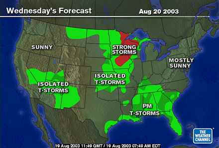
And that little-trough is kicking off severe weather ahead of it.
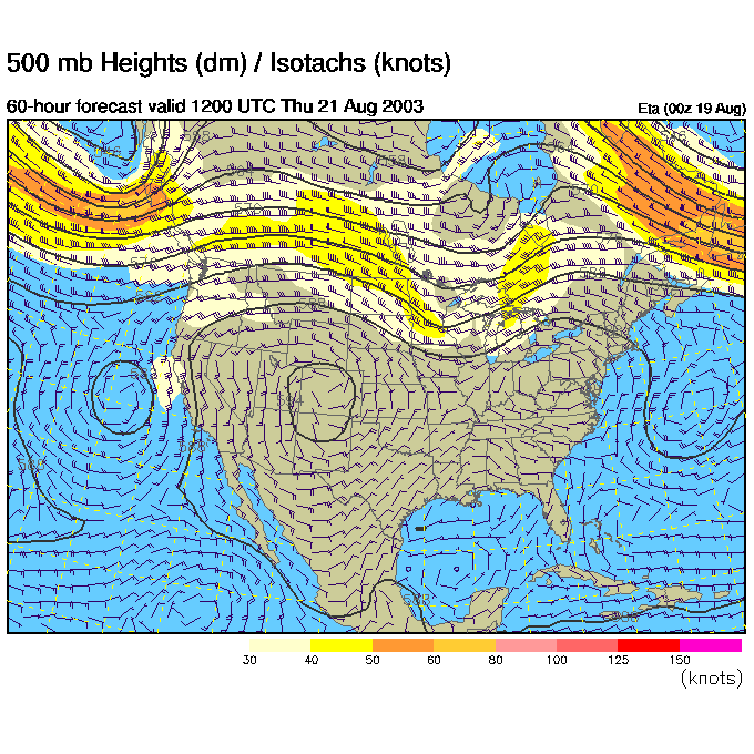
By Thursday AM, the little-trough is almost into the Great Lakes and the ridge is centered on us.
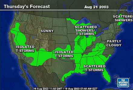
And there are showers and a chance of storms in the Great Lakes because of it.
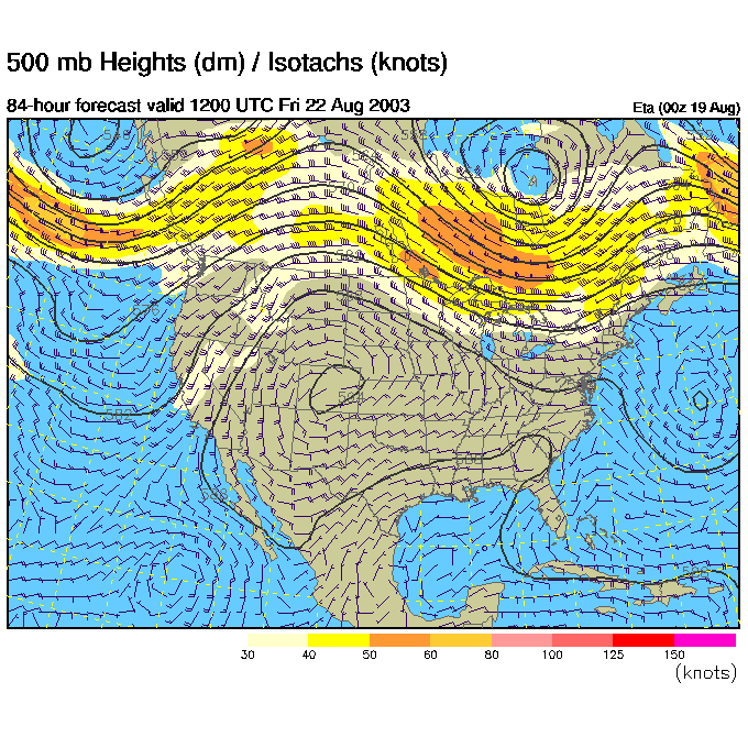
Then for Friday AM, the little-trough is merging with a building trough coming down out of Canada and is back where it started 2 and half weeks earlier.
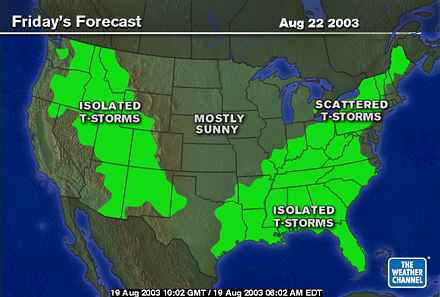
And it pushes a weak front into the eastern US increasing a chance of rain and bringing slightly cooler weather with it.
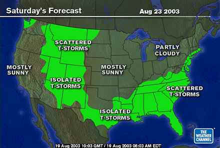
By Saturday, the front already moving off to the south east again and we are a bit cooler and drier again.
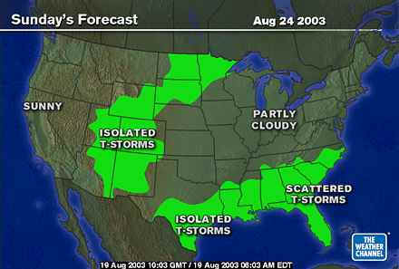
For Sunday (so you can glimpse your entire weekend), we will be in very nice (slightly) cooler and drier air with no rain.
I'll see you tomorrow and stay cool!
Meteorologist John Ensworth
Surface Station sky cover color key:
Flight category definitions:| Category | Ceiling | Visibility | |
|---|---|---|---|
| Low Instrument Flight Rules LIFR* (magenta circle) |
below 500 feet AGL | and/or | less than 1 mile |
| Instrument Flight Rules IFR (red circle) |
500 to below 1,000 feet AGL | and/or | 1 mile to less than 3 miles |
| Marginal Visual Flight Rules MVFR (blue circle) |
1,000 to 3,000 feet AGL | and/or | 3 to 5 miles |
| Visual Flight Rules VFR+ (green circle) |
greater than 3,000 feet AGL | and | greater than 5 miles |
| *By definition, IFR is ceiling less than 1,000 feet
AGL and/or visibility less than 3 miles while LIFR
is a sub-category of IFR. +By definition, VFR is ceiling greater than or equal to 1,000 feet AGL and visibility greater than or equal to 3 miles while MVFR is a sub-category of VFR. |
|||