Back To Home
The Story Behind the Weather - By Forecaster John
Ensworth M.S. -
The Discussion of Weather Events Daily for Philadelphia and Pennsylvania
Last updated: 09/14/2003 02:36 PM
Good Morning Philadelphia!
There went summer! Here is early Fall again. It got quite toasty yesterday (10 degrees above normal), and even though we were under severe thunderstorm watches for a while, the Philadelphia area officially only received a trace of rain. We are still about 2.5 inches above normal for the year.
| Actual | Normal | Record | Last year | |
|---|---|---|---|---|
| Yesterday | ||||
| High temperature | 93° | 83° | 97° (1916) | 89° |
| Low temperature | 76° | 68° | 52° (1940) | 68° |
| Precipitation | T " | 0.12 " | 1.24 " ( 1887 ) | 0.03 " |
| Month-to-date precip. | 2.75 " | 2.71 " | -- | 0.03 " |
| Year-to-date precip. | 30.24 " | 27.84 " | -- | 18.63 " |
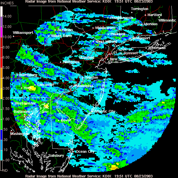
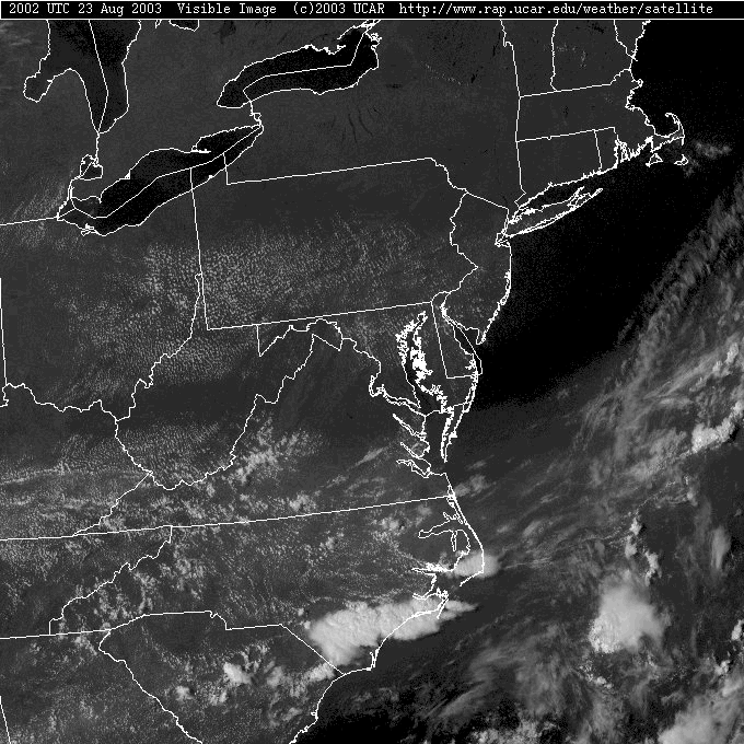
As the storms moved across the area yesterday (from the WNW to the ESE) some areas got up to 2 inches of water, but Philadelphia was spared.
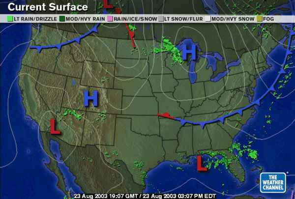
The surface map shows the front is marching happily away to the south and east. The High pressure (that is cool and dry air) behind the front is centered over the Great Lakes.
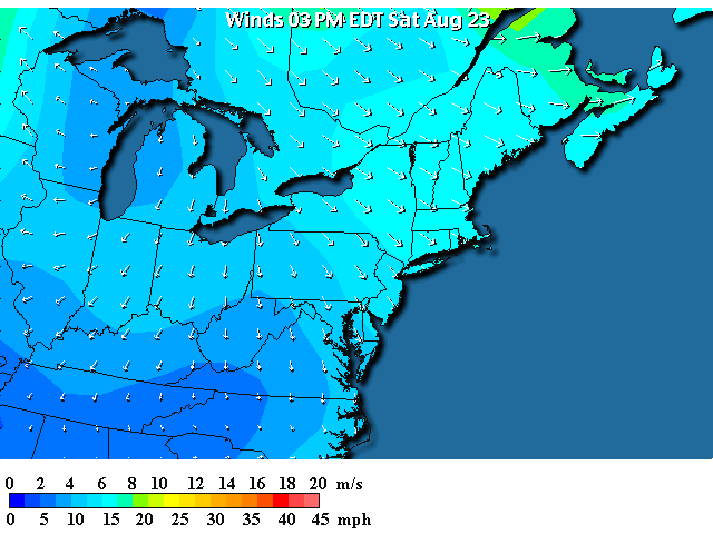
The winds are quite brisk out of the north and northwest. Though this down hill flow warms some due to compression, the air is starting out cool and is still cool when it gets here.
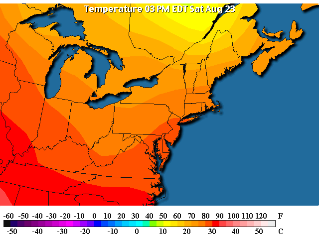
Temperatures are in the 70's over most of the state and barely into the 80's near Philadelphia this afternoon.
Skies are mostly clear except for what is called 'cold air' cumulus. It often forms after a cold front when the surface is warm (either due to a high sun in August, or warm ocean water). The warm surface air rises into the cool air aloft making nice cumulus clouds. These are good for laying out in the grass and making bunnies and the like out of them.
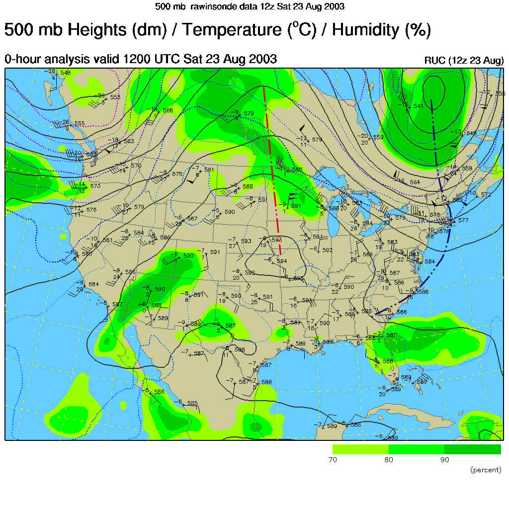
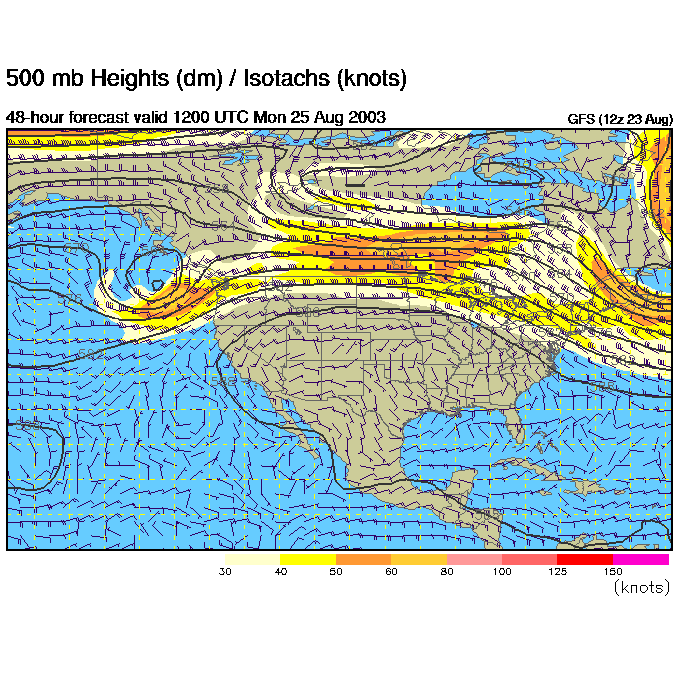
The upper air pattern shows the big trough that just cooled us down (marked in blue) moving off to the east. The ridge in the central US is making it HOT out there, but is keeping us dry for now.
Sunday morning shows the ridge in the central US broader, and the trough further off to the east.
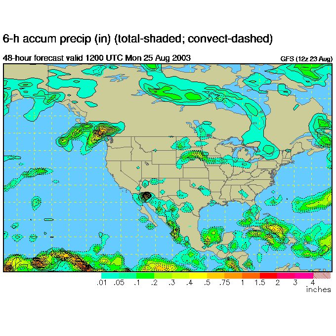
There will be no chance of rain here tomorrow.
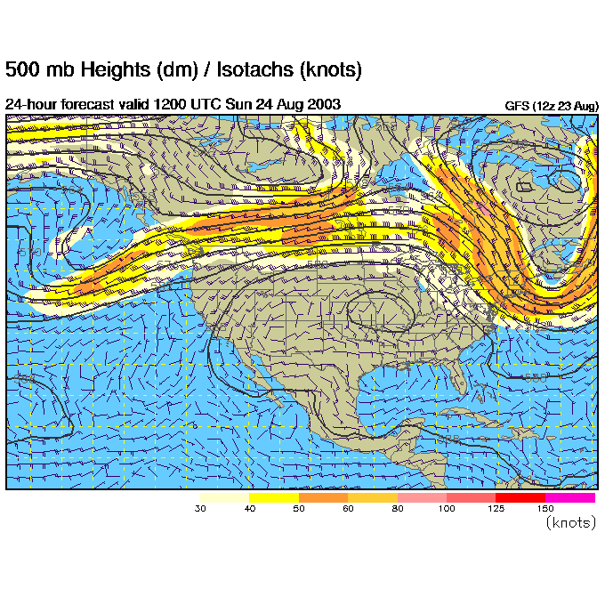
The jet stream flow (where the lines are closest together and the winds are highest (yellows, oranges... etc.) is becoming flat. The ridge is really broad over the entire US. That is a warm up for everyone!
But Monday will still be dry for us.
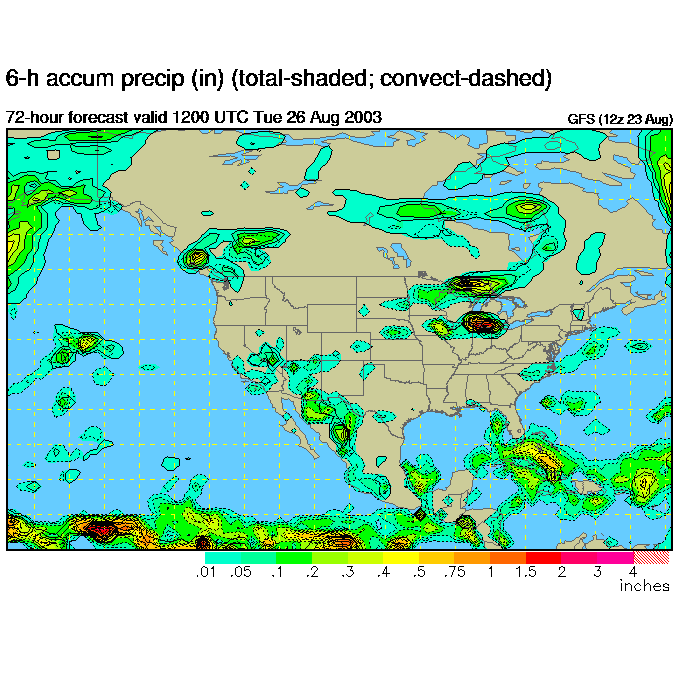
Tuesday morning and little has changed...
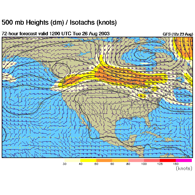
And the story is the same as far as precipitation goes.
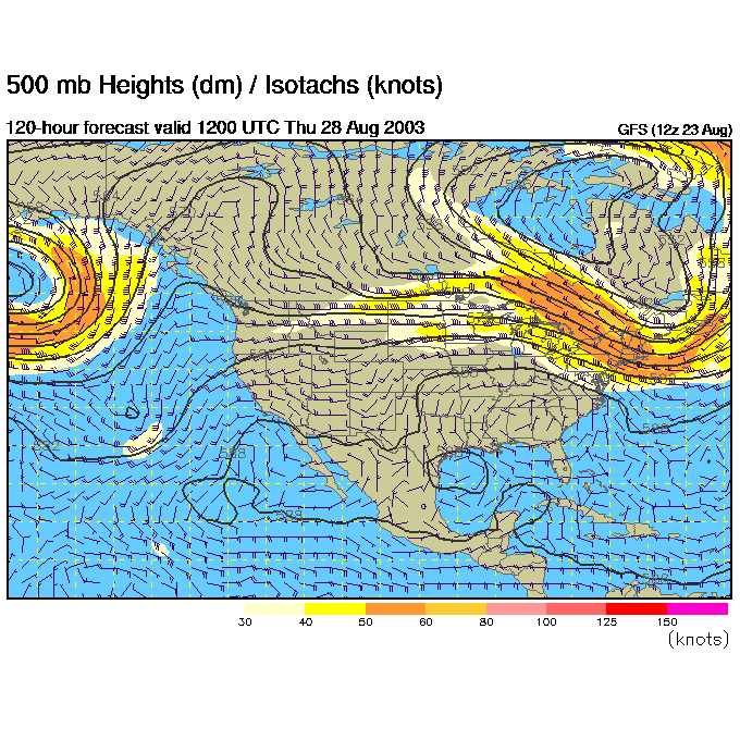
By Thursday morning (if the GFS is right), the trough is deepening to our east, and a trough is deepening in the West. This means a ridge is inching towards us.
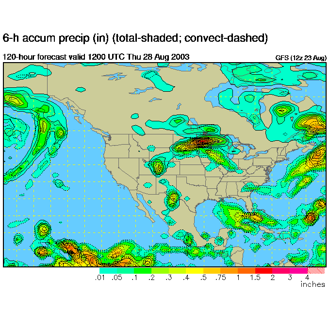
But still no rain.
By Friday morning, the jet stream is further south over our heads (meaning cool air is slipping in) and the trough out west is forming (well there is a ridge over trough on the west coast, but that doesn't directly effect us at this moment.
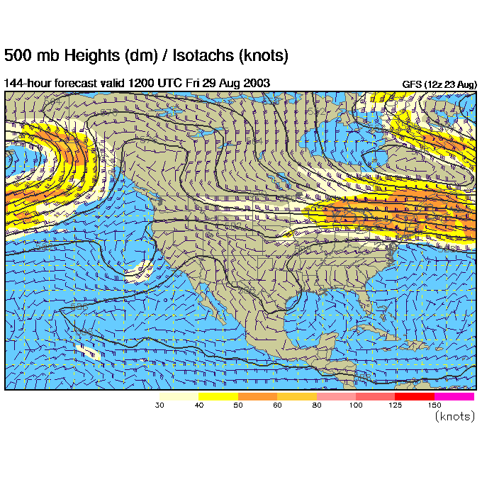
And as that cool air approaches, storms break out to the north.

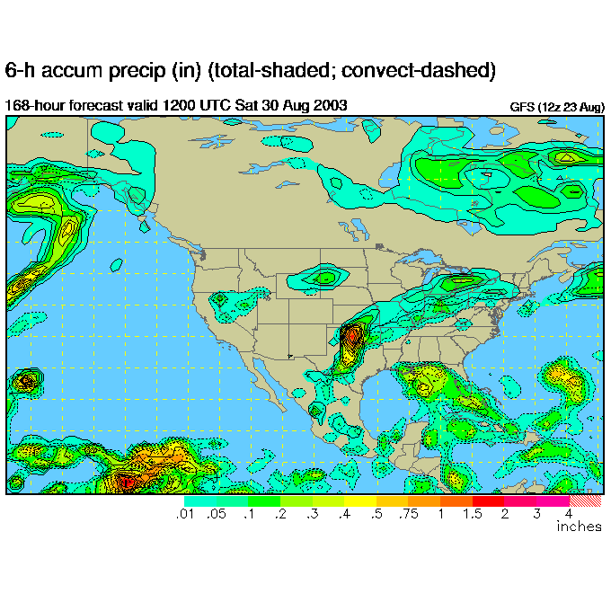
Finally, a chance of scattered showers hits a week from now.
Expect a warming, but near normal and mostly dry week.
I'll see you Monday... enjoy the weather!
Meteorologist John Ensworth
Surface Station sky cover color key:
Flight category definitions:| Category | Ceiling | Visibility | |
|---|---|---|---|
| Low Instrument Flight Rules LIFR* (magenta circle) |
below 500 feet AGL | and/or | less than 1 mile |
| Instrument Flight Rules IFR (red circle) |
500 to below 1,000 feet AGL | and/or | 1 mile to less than 3 miles |
| Marginal Visual Flight Rules MVFR (blue circle) |
1,000 to 3,000 feet AGL | and/or | 3 to 5 miles |
| Visual Flight Rules VFR+ (green circle) |
greater than 3,000 feet AGL | and | greater than 5 miles |
| *By definition, IFR is ceiling less than 1,000 feet
AGL and/or visibility less than 3 miles while LIFR
is a sub-category of IFR. +By definition, VFR is ceiling greater than or equal to 1,000 feet AGL and visibility greater than or equal to 3 miles while MVFR is a sub-category of VFR. |
|||