Back To Home
The Story Behind the Weather - By Forecaster John
Ensworth M.S. -
The Discussion of Weather Events Daily for Philadelphia and Pennsylvania
Last updated: 09/14/2003 02:37 PM
Good Morning Philadelphia! Unfortunately, the server I use to host this site is down this weekend, so you are not going to see it 'live'. Because of that, I'll just show a few images to support the last two discussions. The story is holding firm, and periods of rain are going to continue for the foreseeable future (3-5days) as systems come to a crashing halt against the big Bermuda High pressure system to our southeast.
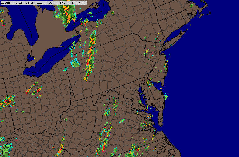
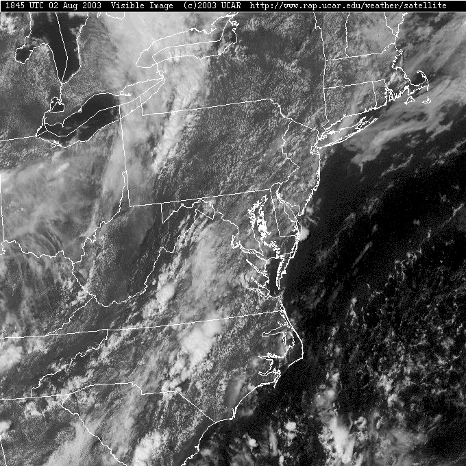
The radar view this afternoon shows the next round of convective storms forming and heading our way from the west. We're enjoying a hot, humid break in the rain this Saturday...
...with mostly cloud skies in that humid tropical flow over our heads.
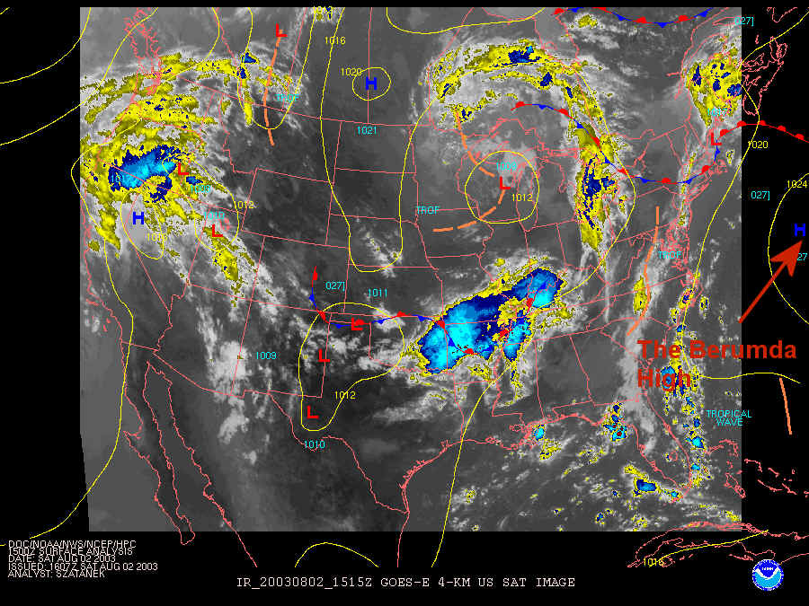
The front is north of us in New York state and there is a thin back of the last wave of moisture that hit us smashed up against the Bermuda High (see label) on the coast. The next area of high clouds (blues and yellows) and storms is approaching from the west.
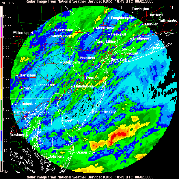
Rainfall over the last couple of days shows Philadelphia getting between a half inch and locally two inches! And that is only the start for this pattern.
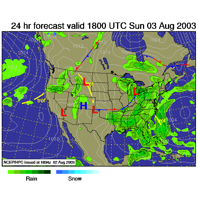
Sunday afternoon brings more rain approaching from the west...
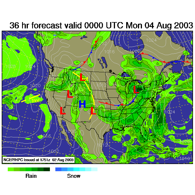
As does Sunday night. Moisture is abundant and the slow low over the Great Lakes keeps throwing convection our way.
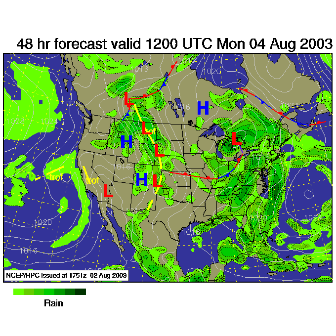
And Monday morning... more rain than ever! Note the circle within a circle over the eastern Atlantic for the Bermuda high.
Remember, from the earlier two discussions, a LOT of water will hit the state this first part of the week. Some places may total 2 feet! Get ready for some stream and river flooding if all that happens.
Hopefully the servers will be working on Monday and I'll be able to post live again.
Until then, keep looking up!
Meteorologist John Ensworth
Surface Station sky cover color key:
Flight category definitions:| Category | Ceiling | Visibility | |
|---|---|---|---|
| Low Instrument Flight Rules LIFR* (magenta circle) |
below 500 feet AGL | and/or | less than 1 mile |
| Instrument Flight Rules IFR (red circle) |
500 to below 1,000 feet AGL | and/or | 1 mile to less than 3 miles |
| Marginal Visual Flight Rules MVFR (blue circle) |
1,000 to 3,000 feet AGL | and/or | 3 to 5 miles |
| Visual Flight Rules VFR+ (green circle) |
greater than 3,000 feet AGL | and | greater than 5 miles |
| *By definition, IFR is ceiling less than 1,000 feet
AGL and/or visibility less than 3 miles while LIFR
is a sub-category of IFR. +By definition, VFR is ceiling greater than or equal to 1,000 feet AGL and visibility greater than or equal to 3 miles while MVFR is a sub-category of VFR. |
|||