Back To Home
The Story Behind the Weather - By Forecaster John
Ensworth M.S. -
The Discussion of Weather Events Daily for Philadelphia and Pennsylvania
Last updated: 09/14/2003 02:38 PM
Good Morning Philadelphia!
The server this page resides on continues to be down today... so no one will be able to see this live. I'll, again, quickly recap what is happening, and wait for the big diagnosis to return when the power is back on! Update, the UPS is out and one will be ordered Thursday. Yikes.
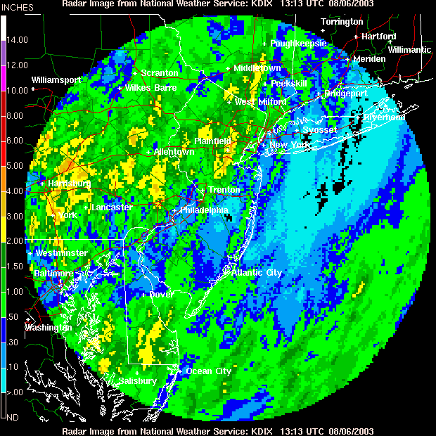
Some places in the state have (according to the National Weather Service - NWS), in just the last 24 hours, have received 0 inches of rain, and some places have received 5-6 inches! Some local spots have probably reached the predicted 2 feet of rain for this storm period beginning last week. Amazing. The heaviest hit places include Lehigh, Carbon and Montgomery in Pennsylvania and Middlesex and Somerset in northern New Jersey. All this is due to the transport of tropical moisture northward ahead of this stationary front to our west.
You don't need a hurricane or tropical storm to get tropical rains!
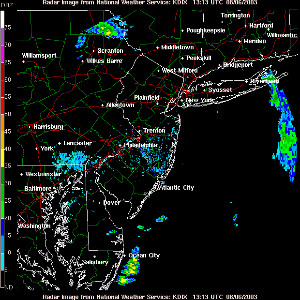
Thankfully, we're getting a break this morning. The showers are pulling off to the northeast and east.
But the last day and a half has seen 2-4" over many locations around and to the north and east of the Philadelphia area. Some of this was enhanced by the hills and highlands of the Piedmont Plateau. There is significantly less rainfall on the Coastal Plains. Tropical moisture acts like this. Give it a bit of lift (make it flow up hill) and shower and storm fire like crazy!
Showers and thunderstorms are almost non-existent this morning. This is the normal diurnal fluctuations we've seen so far. The addition of heating in the afternoon gives more lift and makes the atmosphere more unstable. Wait for the afternoon drive to see some more rain.
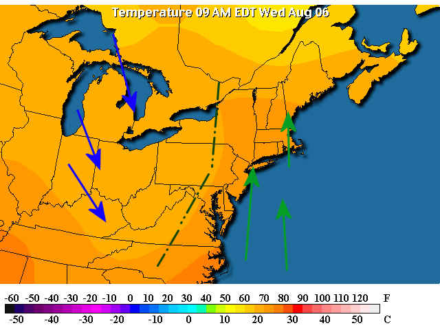
The front is still to our west (but marginally closer). The green arrows show the flow northward of the abovementioned tropical moisture (flowing clockwise around the Bermuda high off the map to the east. The slightly cooler drier air behind the front isn't making it here with so slow a progression of the upper air pattern (see below).
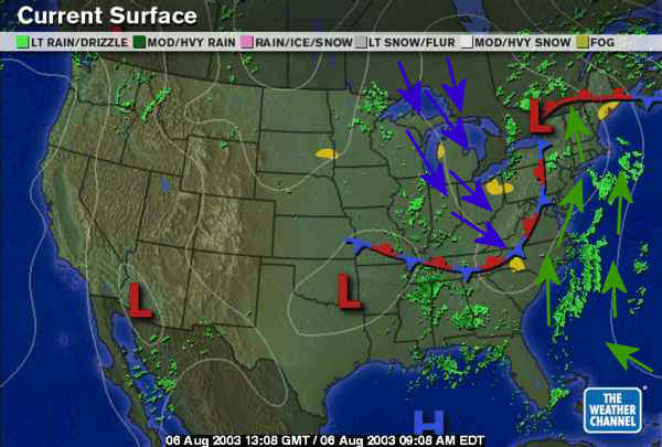
Looking at temperatures, you can see the slightly cooler air behind the front (marked in black) and the flow northward to the east.
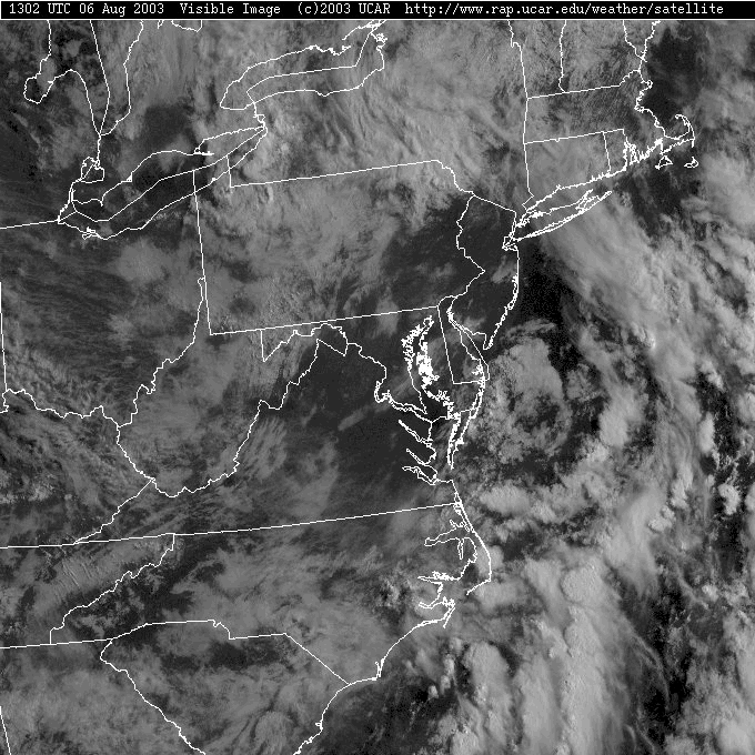
Clouds have broken up this morning with the closest convection visible as the lumpy bright white clouds off over the ocean. Enjoy the steamy warm sunshine.
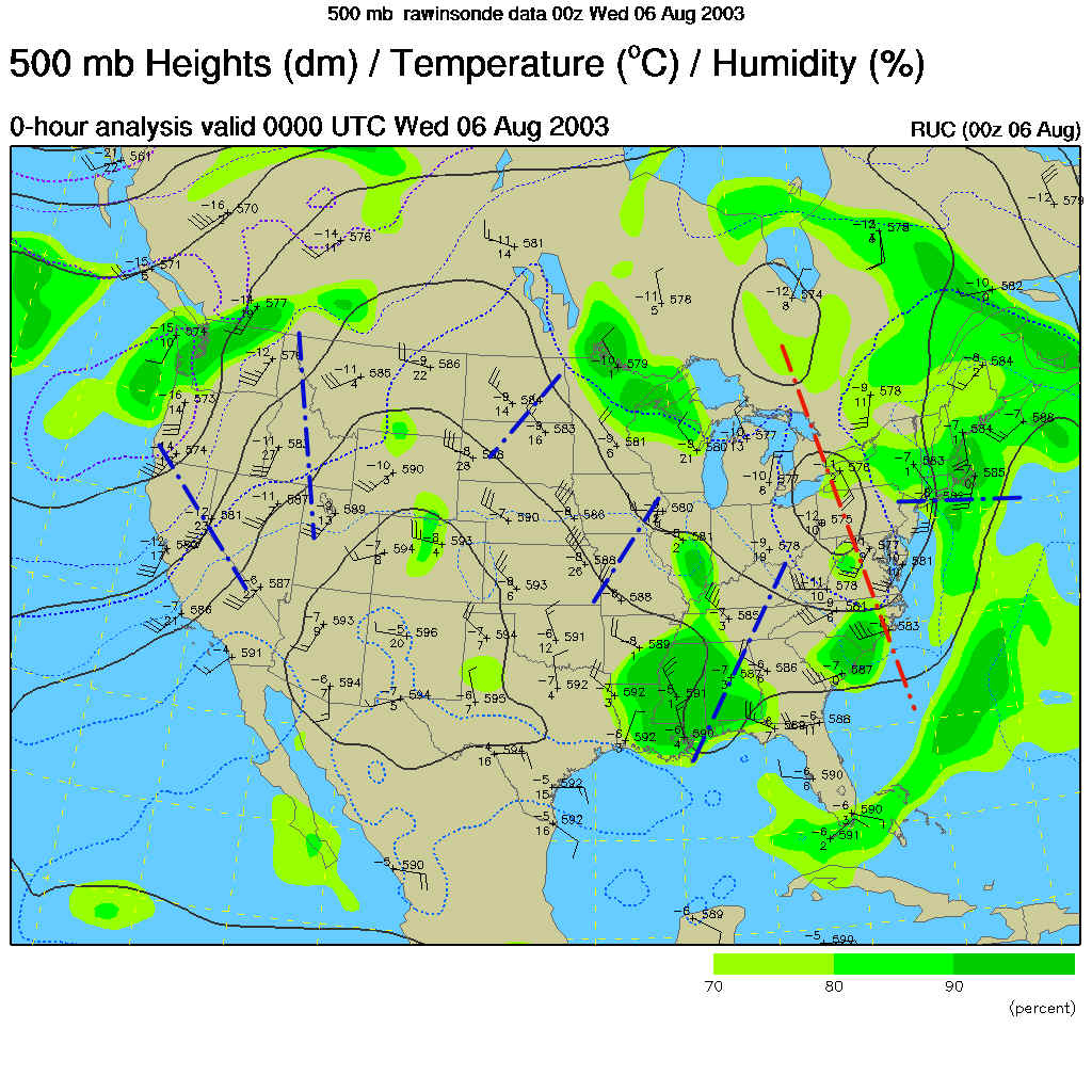
The upper air trough in the map below (marked in red) has slipped a bit eastward and that has allowed the surface front to ooze a bit eastward. The blue dashed lines mark short waves, or ripples of cooler air in the flow that can kick off storms and showers when the surface is warm and moist (like it is now!). There are plenty of these moving along to make more rain over the next few days.
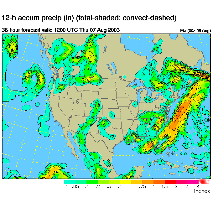
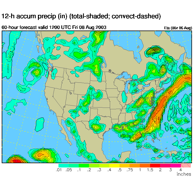
The computer models are showing much more scattered showers over the next few days (this map is for Thursday 8am). With the upper trough sliding a bit eastward, we see the heaviest rain off the coast now. This is a welcome break.
By Friday morning, the heaviest rain is off in the ocean, but a shortwave is kicking off showers and thunderstorms over southern and eastern Pennsylvania. Yipiee, more rain.
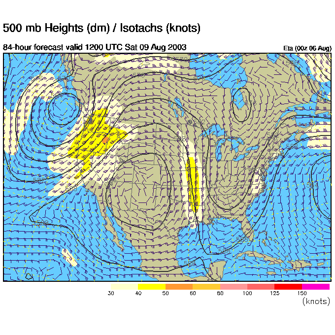
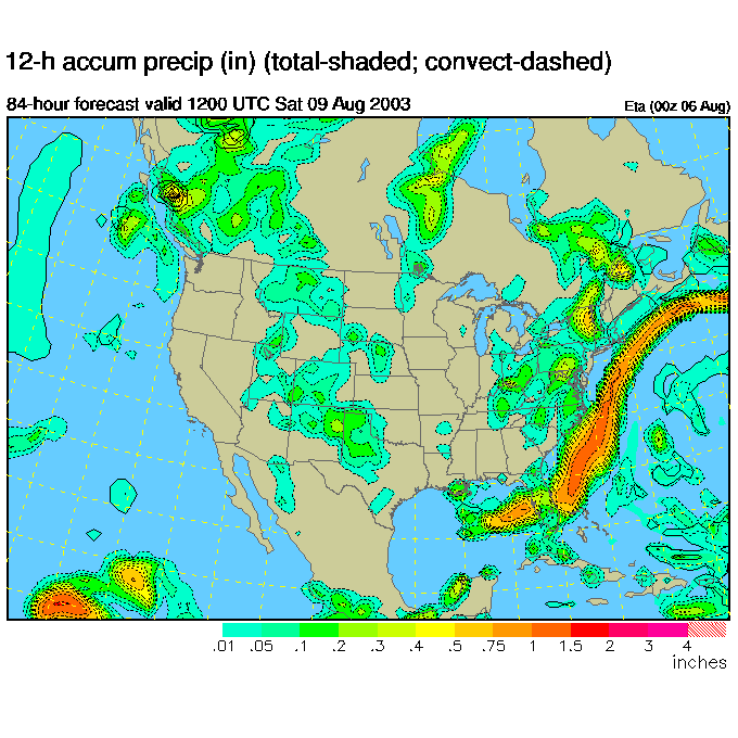
By Saturday morning, the models predict that the trough will be forming further to the west again. It is backing up. We call this retrogression.
And in response to that, the rain begins to form a bit more firmly over our state again.
Rain, chances of rain, and scattered showers will be the story for many days to come.
Hopefully the servers will be working soon and I'll be able to post live again.
Until then, keep looking up and stay dry!
Meteorologist John Ensworth
Surface Station sky cover color key:
Flight category definitions:| Category | Ceiling | Visibility | |
|---|---|---|---|
| Low Instrument Flight Rules LIFR* (magenta circle) |
below 500 feet AGL | and/or | less than 1 mile |
| Instrument Flight Rules IFR (red circle) |
500 to below 1,000 feet AGL | and/or | 1 mile to less than 3 miles |
| Marginal Visual Flight Rules MVFR (blue circle) |
1,000 to 3,000 feet AGL | and/or | 3 to 5 miles |
| Visual Flight Rules VFR+ (green circle) |
greater than 3,000 feet AGL | and | greater than 5 miles |
| *By definition, IFR is ceiling less than 1,000 feet
AGL and/or visibility less than 3 miles while LIFR
is a sub-category of IFR. +By definition, VFR is ceiling greater than or equal to 1,000 feet AGL and visibility greater than or equal to 3 miles while MVFR is a sub-category of VFR. |
|||