Back To Home
The Story Behind the Weather - By Forecaster John
Ensworth M.S. -
The Discussion of Weather Events Daily for Philadelphia and Pennsylvania
Last updated: 09/14/2003 02:39 PM
Good Morning Philadelphia!
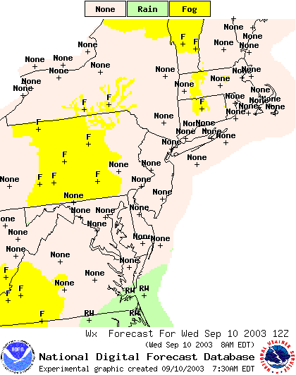
We have low clouds and fog rapidly burning off from the light winds, clear skies, and cool temperatures in the higher elevations to the west.
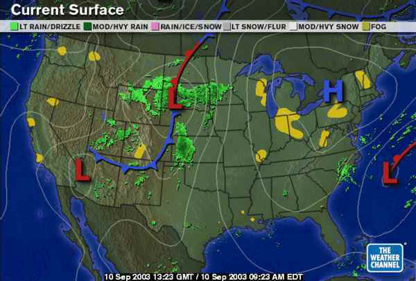
The radar is clear and green (ok, it's NOT green, if it was green - that would be rain all over... sorry).
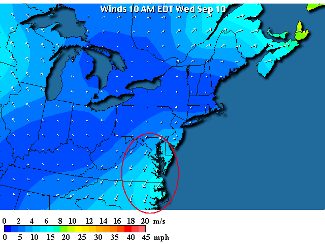
The surface map shows the cool High pressure system that was more distant north of us, is now sitting near the northern Pennsylvania border. Winds are decreasing for now. (You can see the fog regions colored in here as well).
Due to the circulation of the remains of Henri (more on this below) and the high to the north, the circulation around these two pressure systems is feeding air inland off the ocean (air around a low circulates counterclockwise and around a high circulates clockwise). If Henri does move north and northwest, as some models are showing it may do (and I've been warning about for days) then this band of high onshore winds could do some serious coastal damage from here northward (to our shores) into the weekend.
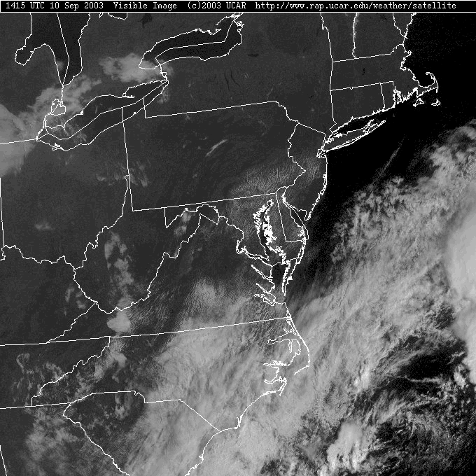
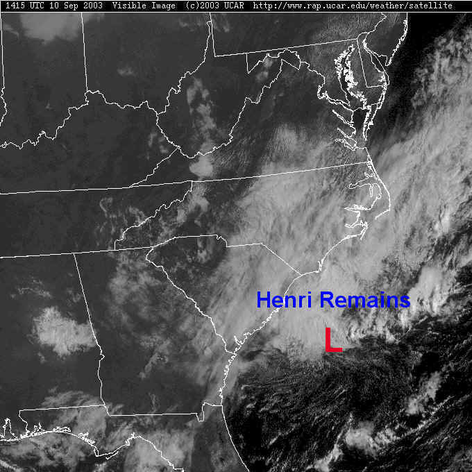
By 1015am (the time this visible satellite view was taken this morning) the fog was almost gone in the interior of the state. Low stratocumulus clouds (a big layer of clumpy clouds) is lingering in the marine moist air over Philadelphia.
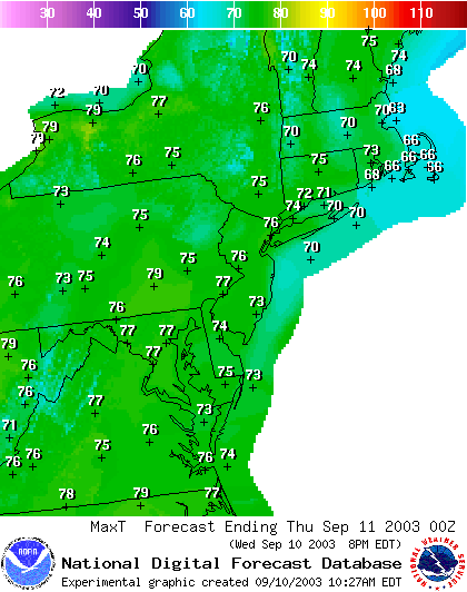
With a high influencing the area and cool onshore breezes, we will climb only to the upper 70's across the region today...
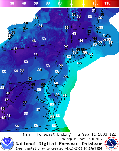
And tonight, under clear skies, we'll drop to the mid 50's (warmer near the coast where onshore breezes will bring Gulf Stream warmed air inland and before it cools under the clear relatively dry skies.
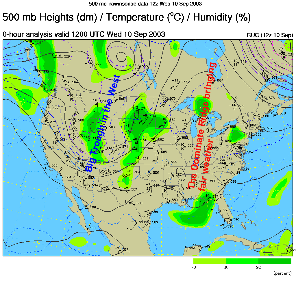
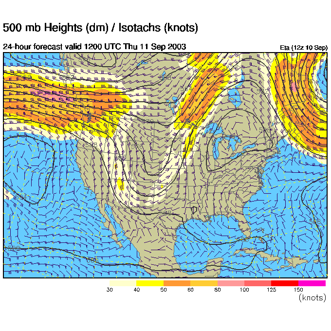
The upper air pattern is very similar to yesterday (see that discussion for the 'what is this' of this map). Our position on the downhill side of the big ridge is allowing that High to remain strong over us. Air is sinking and storms/rain is inhibited. Little has changed so far. IF we had a big trough here, then (like with Hurricane Fabian) the tropical systems would be scooped up and carried out over the distant Atlantic away from us. But with a ridge here, they can happily come slamming into the coast.
Danger danger Will Robinson!
The remains of Tropical System Henri are STILL sitting off the coast to our south and churning around. There STILL is a chance it will head north or even northwest and bring a shot of serious tropical rains to the area by the weekend. But it is hardly moving at all. You'll have to come back for more on this over the next two days.
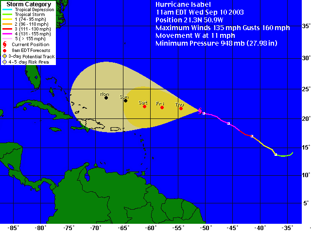
The NEXT spooky tropical attack is Hurricane Isabel. It is a healthy Cat 4 storm heading for the east coast (somewhere - but where is hard to tell... I'd be most nervous in the Carolinas where Henri remains are sitting right now). Chances are after it hits land, we'll get the recurving (heading back to the east as it goes north) moisture. This would be middle- next week.
Now hopping into the future looking at the upper air pattern then the surface conditions we see the ridge over our heads (according to the ETA model) getting stronger.
And we are high and dry (pun intended). The rains from Henri are right on the coast in the Carolinas.
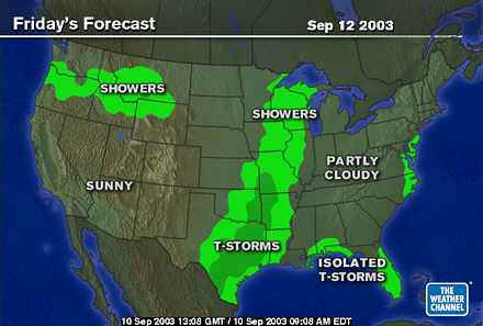
Friday morning and the ridge is bigger and a bit further east (that is NOT good for protecting us from tropical systems).
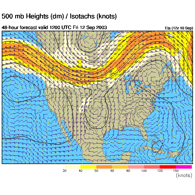
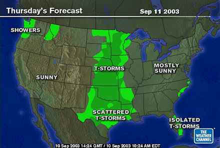
And the moisture from Henri is moving northward under the ridge. This is the chance of showers on the main forecast page.
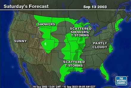
Saturday morning and the ridge is broader and bigger.
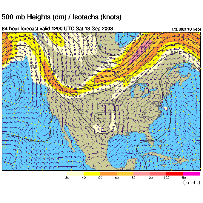
And the remains of Henri may be passing us, on us or south of us. There is a lot of uncertainty here.
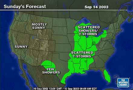
Sunday morning and the ridge is flattening out (this is now the GFS model - so continuity may be a bit flaky) but the 'saving trough' is still over the central plains and not steering tropical system away from the east coast.
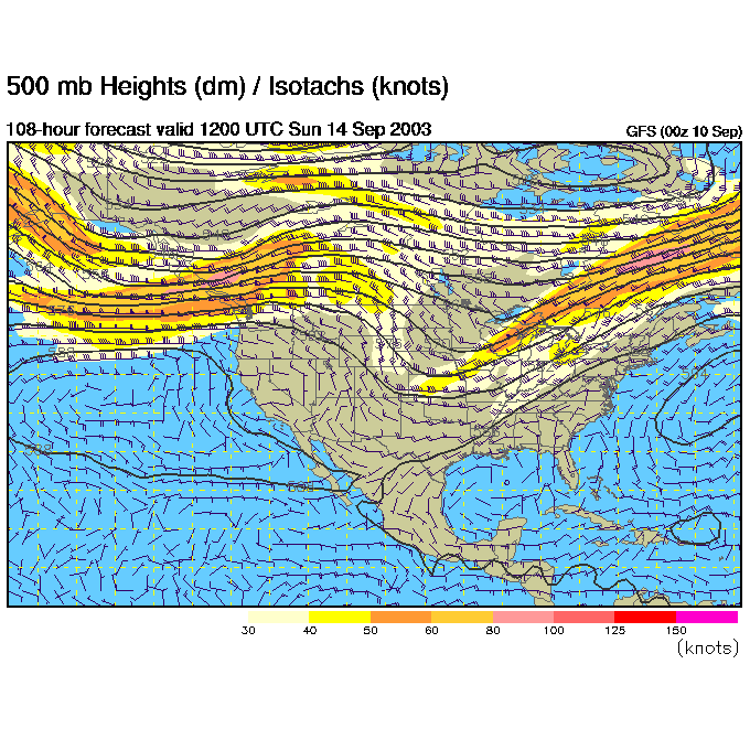
A front is getting it's act together in the Ohio and Mississippi valley, but we are still dry and nice (with the Henri moisture gone by now).
We'll keep an eye on all this together! Until tomorrow... enjoy it!
Meteorologist John Ensworth
Surface Station sky cover color key:
Flight category definitions:| Category | Ceiling | Visibility | |
|---|---|---|---|
| Low Instrument Flight Rules LIFR* (magenta circle) |
below 500 feet AGL | and/or | less than 1 mile |
| Instrument Flight Rules IFR (red circle) |
500 to below 1,000 feet AGL | and/or | 1 mile to less than 3 miles |
| Marginal Visual Flight Rules MVFR (blue circle) |
1,000 to 3,000 feet AGL | and/or | 3 to 5 miles |
| Visual Flight Rules VFR+ (green circle) |
greater than 3,000 feet AGL | and | greater than 5 miles |
| *By definition, IFR is ceiling less than 1,000 feet
AGL and/or visibility less than 3 miles while LIFR
is a sub-category of IFR. +By definition, VFR is ceiling greater than or equal to 1,000 feet AGL and visibility greater than or equal to 3 miles while MVFR is a sub-category of VFR. |
|||