Back To Home
The Story Behind the Weather - By Forecaster John
Ensworth M.S. -
The Discussion of Weather Events Daily for Philadelphia and Pennsylvania
Last updated: 09/22/2003 10:45 AM
Good Morning Philadelphia!
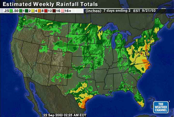
There is a pesky mega-front coming! Yes, more rain by morning. But first, let's peek back at the rainfall for the last week.
From The Weather Channel, you can see the pre-Isabel front, the remains of Henri, and Isabel herself has REALLY saturated the east coast. Many places have seen up to 8 inches of rain. I THINK the rivers and lakes are probably full now. But there is more coming...
The next front(s) are getting their act together and creating a gigantic rain shield ahead of them as they move eastward. You can see Hurricane Marty down in Baja California... yes, we still have a connection to the tropics as you shall shortly see.
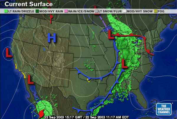
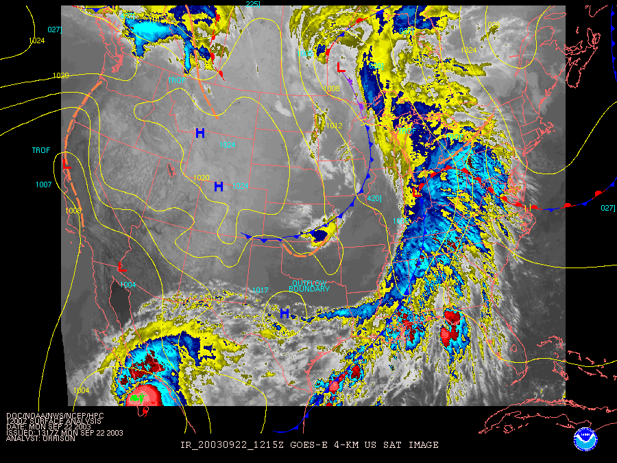
This surface map shows the actual radar superimposed. There is a lot of heavy rain falling!
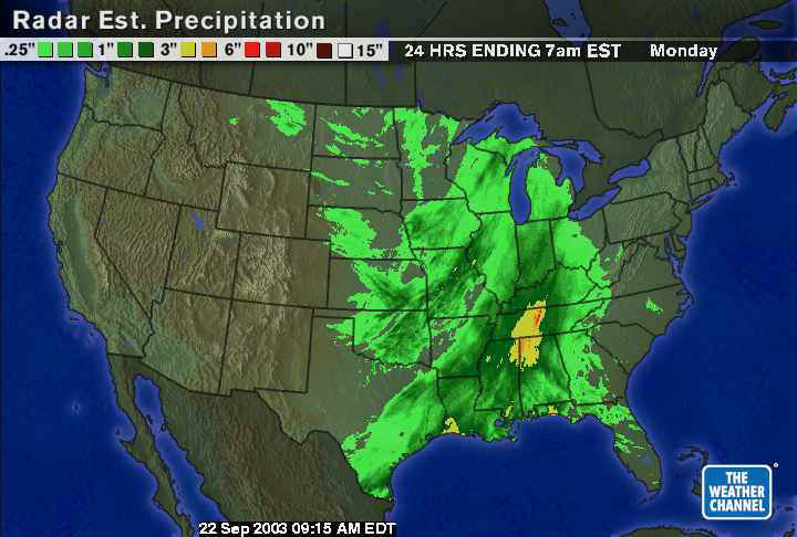
In the last 24hours, this system has dropped a large swath of 1" rainfall amounts with a bull's-eye in Tennessee, Alabama, Mississippi of more than 3".
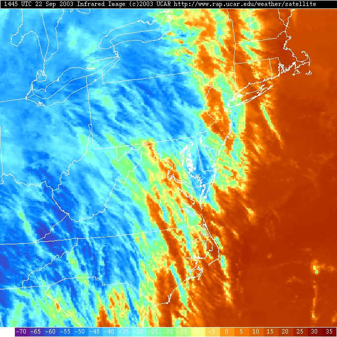
Switching the views on the surface map, now you can see the Infrared satellite view superimposed on the surface map features. The yellows and blues are very cold clouds that are high in the atmosphere (where the temperature is lowest).
The visible satellite view shows the wispy cirrus blowing over our heads and thickening up rapidly.
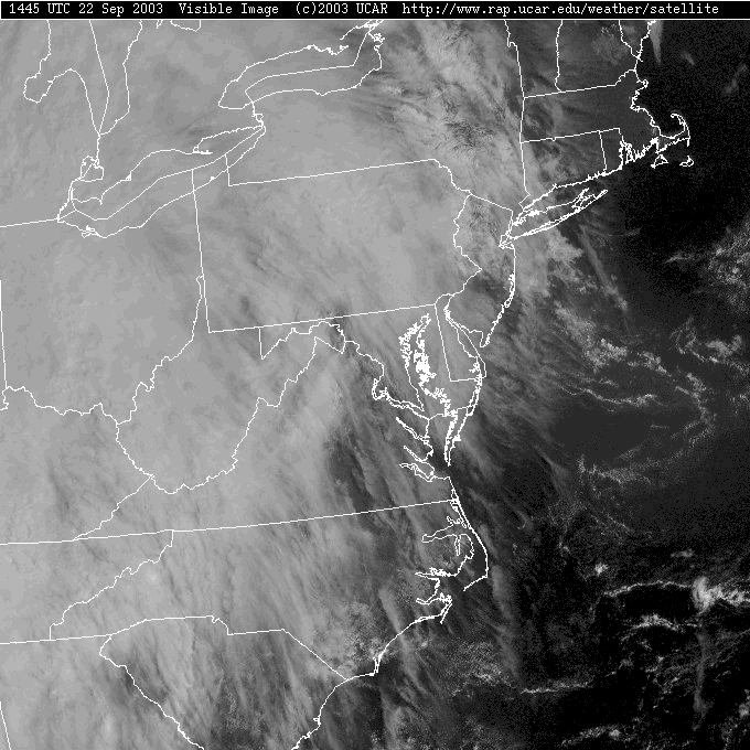
You can see even more interesting feathered structure in the high clouds (high = cold = blue).
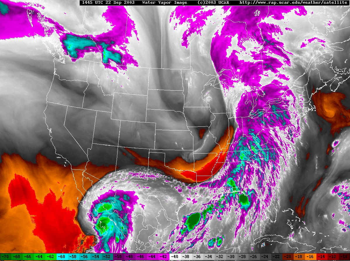
The water vapor satellite view shows a strong plume of moisture that seems to connect Hurricane Marty, across the Gulf of Mexico and up the east coast to us. We are defiantly on the 'tropical' side of the sub-tropical jet.
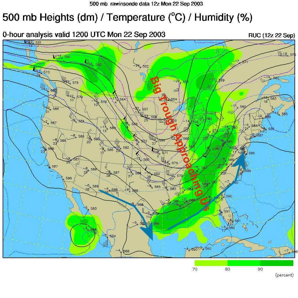
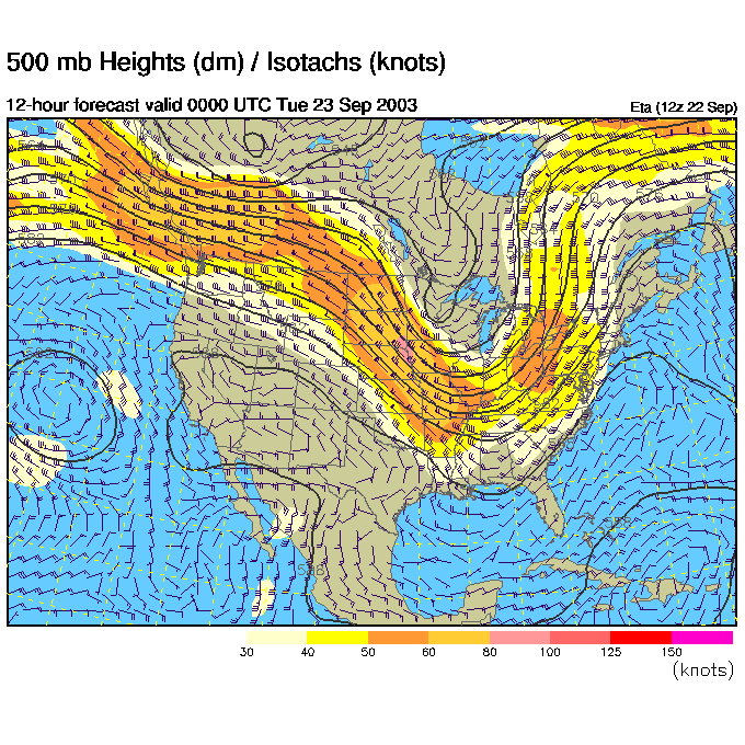
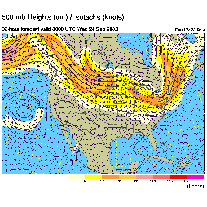
We are on the 'uphill' or right side of the next big trough (marked in red text on the 500mb map below- which shows the airflow mainly west to east across the US at about 18,000 feet above sea level). That is where one would expect the storms to form because the air rises there.
The blue arrows show the flow of moisture from Marty's location towards the east coast.
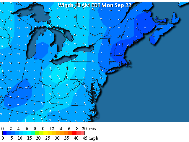
Surface winds (as is to be expected before a front passes) are out of the south east this morning.
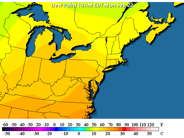
This is bringing in a good flow of tropical surface moisture (as seen in the dew point map shown here) in for the rain tonight...
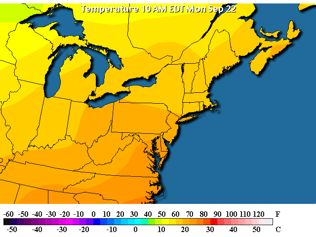
And those winds are bringing in warm air that is 'eager' to rise and make storms (warm air likes to rise, cool air likes to sink).
So looking into the future a day and a half:
We start with the 500mb map tonight at 7pm. The trough is closer to us (it is moving eastward).
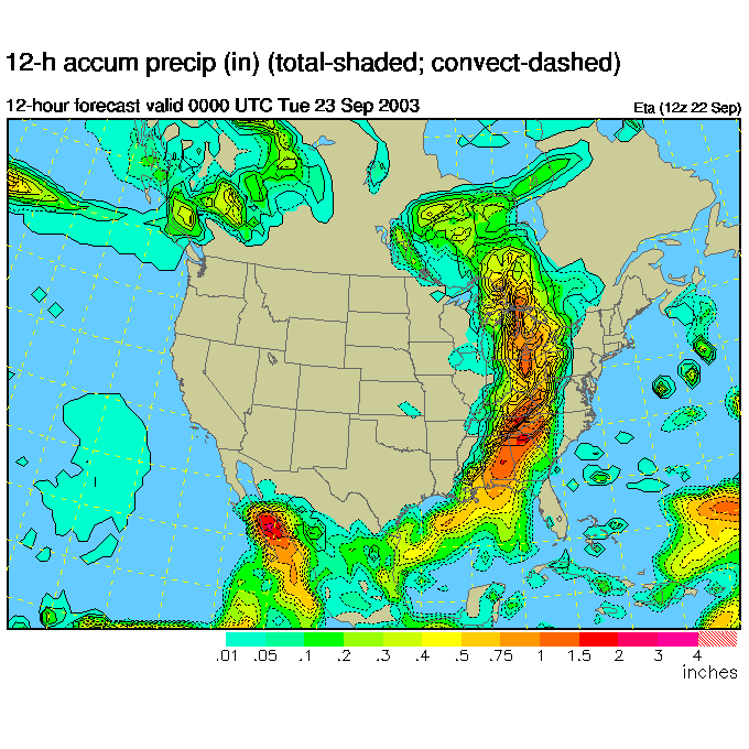
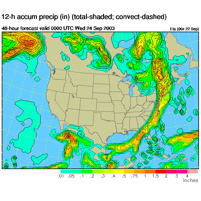
And the front gets closer...and closer, dumping a LOT of water as it moves.
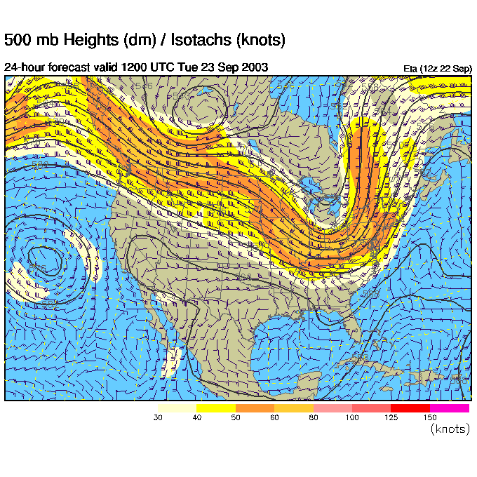
Tuesday morning 8am, the trough axis is now bearing down on us...
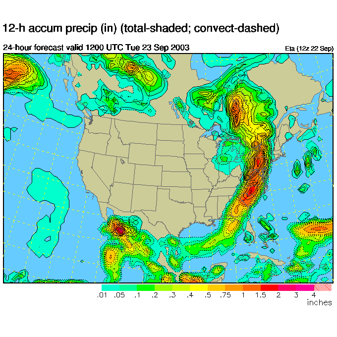
And we are getting a large area of thunderstorms and heavy rainfall.
Tuesday night 8pm, the trough has passed us...
And the front weakens and heads out to sea to the east.
So stay dry and I'll see you tomorrow morning, in the rain.
Meteorologist John Ensworth
Surface Station sky cover color key:
Flight category definitions:| Category | Ceiling | Visibility | |
|---|---|---|---|
| Low Instrument Flight Rules LIFR* (magenta circle) |
below 500 feet AGL | and/or | less than 1 mile |
| Instrument Flight Rules IFR (red circle) |
500 to below 1,000 feet AGL | and/or | 1 mile to less than 3 miles |
| Marginal Visual Flight Rules MVFR (blue circle) |
1,000 to 3,000 feet AGL | and/or | 3 to 5 miles |
| Visual Flight Rules VFR+ (green circle) |
greater than 3,000 feet AGL | and | greater than 5 miles |
| *By definition, IFR is ceiling less than 1,000 feet
AGL and/or visibility less than 3 miles while LIFR
is a sub-category of IFR. +By definition, VFR is ceiling greater than or equal to 1,000 feet AGL and visibility greater than or equal to 3 miles while MVFR is a sub-category of VFR. |
|||