Back To Home
The Story Behind the Weather - By Forecaster John
Ensworth M.S. -
The Discussion of Weather Events Daily for Philadelphia and Pennsylvania
Last updated: 09/27/2003 10:04 AM
Good Morning Philadelphia!
I'm sorry to announce that these discussions will end at the end of September. They are taking up a HUGE amount of server space. If you REALLY want them to continue, email me. Otherwise feel free to use the archives as teaching tools. There are many good case studies in there - including
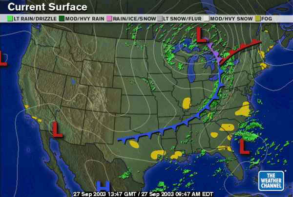
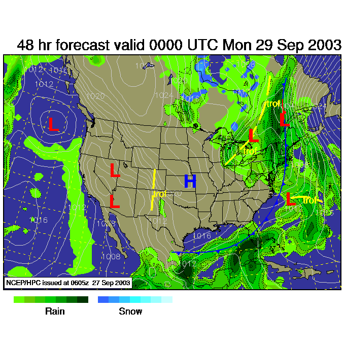
On the surface map this morning, we see the next mega-front on its way.
The stationary front on our heads has pushed northward and is just leaving the US as a warm front.
The push behind (and ahead?!) of this front is the strong southerly (from the south) surface winds streaming northward east of the Appalachian Range.
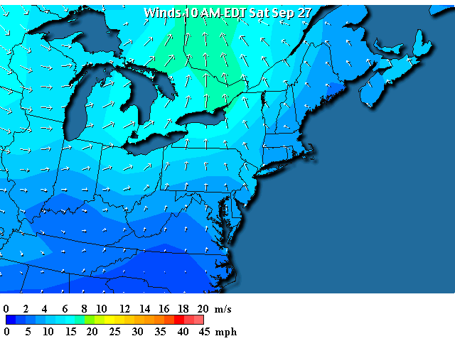
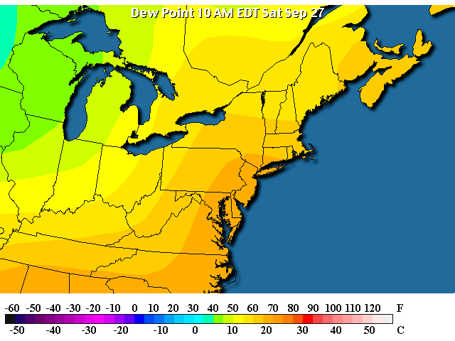
With these strong south winds, warm temperatures have ripped northward over Philadelphia and into Canada with morning temperatures already in the upper 70's!
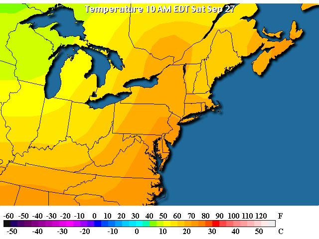
The moisture (as seen by higher dew points) has likewise roared northward from the tropics and warm ocean.
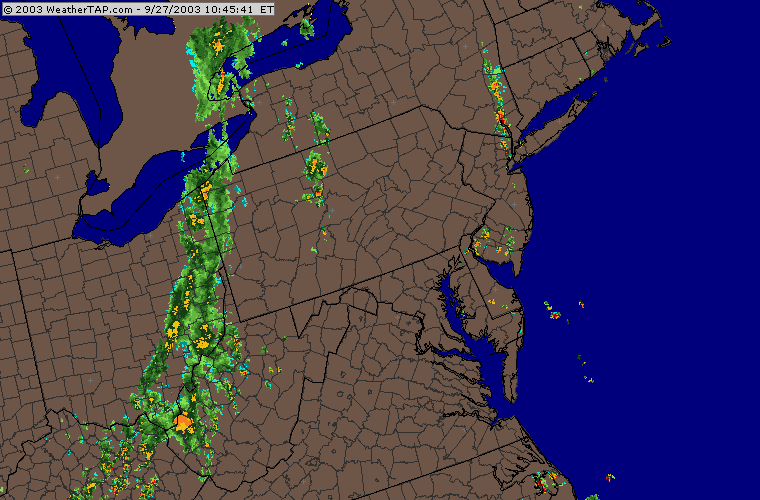
The line of thunderstorms can be seen just entering Pennsylvania this morning with a few scattered showers popping up ahead of the front (giving us an early chance of rain).
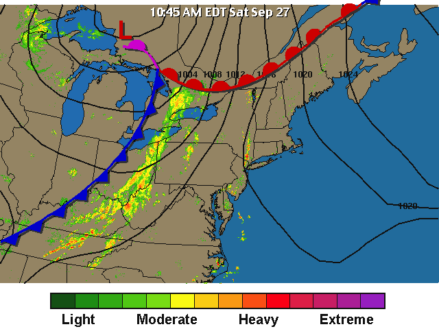
And like the last storm, this one is dumping a lot of water as it moves slowly eastward. The darker greens there are 1-3" rainfall amounts! And they are happening at our latitude.
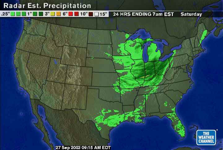
Because of the wet ground around the region from uncountable storms this year, the NWS has issued (wisely ) a flash flood watch in advance of this next hit of water.
![]()
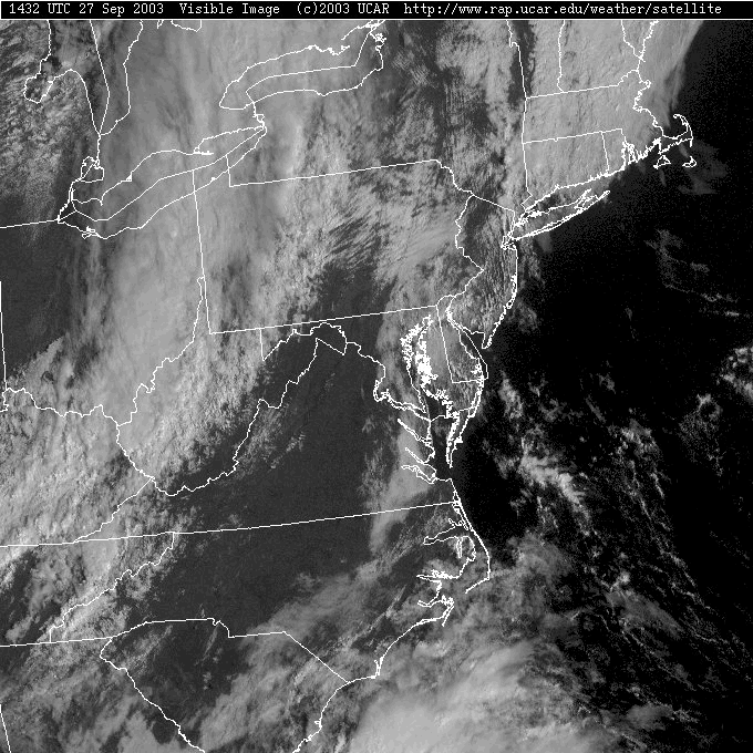
The visible satellite picture shows clouds around Philadelphia, a break with sunshine (and warming sun that will destabilize the atmosphere more as the day goes on) then the real storm clouds out west. Is there a difference between the clouds over us and the clouds on the front?
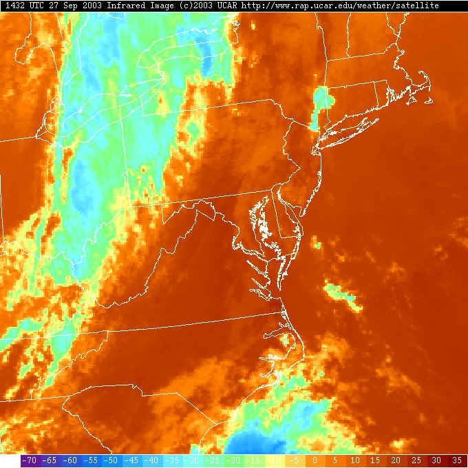
The infrared satellite picture shows the colder and higher clouds (or deeper clouds when thunderstorms are concerned) are all out west on the front. The clouds near us are about the same temperature as the ground so they hardly show up on this view. They are more fog/low status than anything significant.
Looking out a couple of days, overnight tonight the front reaches Philadelphia on it's slow crawl eastward with intense rainfall associated with it.
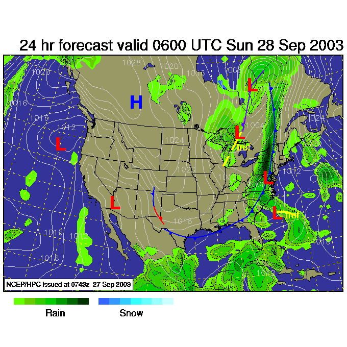
Sunday morning and the front hasn't moved very far (the low forming to our south will slow the progress of the front as well). More rain hit central Pennsylvania.
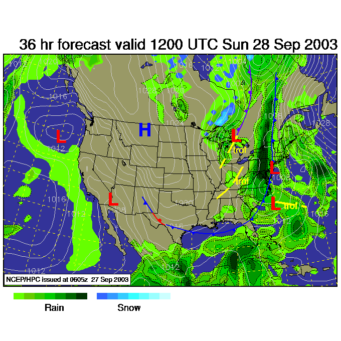
Then for Sunday night - the front is just to our east, but there is plenty of upper level moisture and convergence (air colliding together at the surface) to make rain and rain showers linger.
So enjoy this dry morning / day. Rain will be the story after this.
I'll see you again for one of the last discussions on Monday!
Remember, these forecasts will end Sept 30th. Email me if you wish them to continue. Just a few loyal viewers can keep it going!
Meteorologist John Ensworth
Surface Station sky cover color key:
Flight category definitions:| Category | Ceiling | Visibility | |
|---|---|---|---|
| Low Instrument Flight Rules LIFR* (magenta circle) |
below 500 feet AGL | and/or | less than 1 mile |
| Instrument Flight Rules IFR (red circle) |
500 to below 1,000 feet AGL | and/or | 1 mile to less than 3 miles |
| Marginal Visual Flight Rules MVFR (blue circle) |
1,000 to 3,000 feet AGL | and/or | 3 to 5 miles |
| Visual Flight Rules VFR+ (green circle) |
greater than 3,000 feet AGL | and | greater than 5 miles |
| *By definition, IFR is ceiling less than 1,000 feet
AGL and/or visibility less than 3 miles while LIFR
is a sub-category of IFR. +By definition, VFR is ceiling greater than or equal to 1,000 feet AGL and visibility greater than or equal to 3 miles while MVFR is a sub-category of VFR. |
|||