Back To Home
The Story Behind the Weather - By Forecaster John
Ensworth M.S. -
The Discussion of Weather Events Daily for Philadelphia and Pennsylvania
Last updated: 09/14/2003 02:41 PM
Good Afternoon Philadelphia!
Oh boy do we have some possible fun in the future...and the nice innocent cool beautiful weather of this weekend is making it not obvious. So lets see what might be coming:
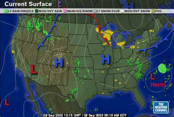
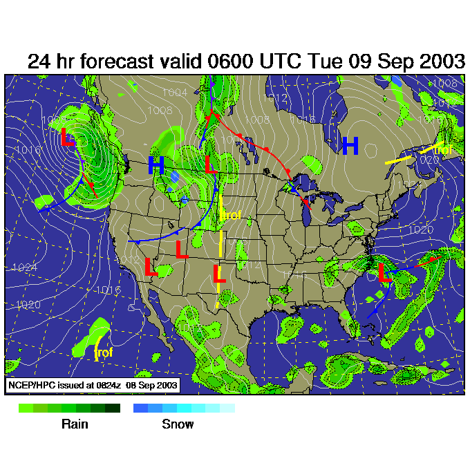
We have a mild cool front sagging southward over us. Just as a point of interest, do you see the warm front over Wisconsin and extending up into Canada? See how the front ends near Chicago? Then our front ends in SW PA? There IS a frontal boundary that connects those two, and it should probably be marked as a stationary front (there really is just one long boundary between the polar region air and the mid-latitude or tropical regions that circles the Earth).
Just to illustrate that point, look at the frontal analysis from the National Weather Service. The front are all one continuous edge between air across Canada and the north, and the body of the U.S.
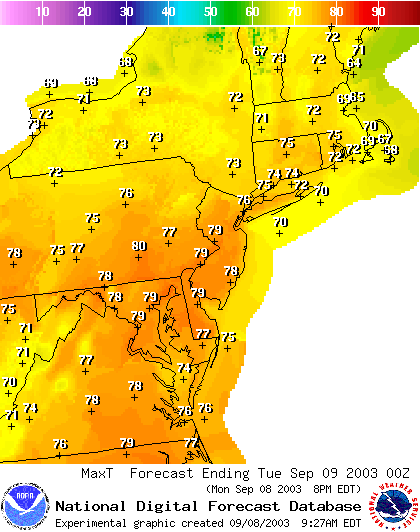
Today's forecast high is a pretty mild 79 across the area (cooler near the coast where onshore breezes will bring in cool moist air.
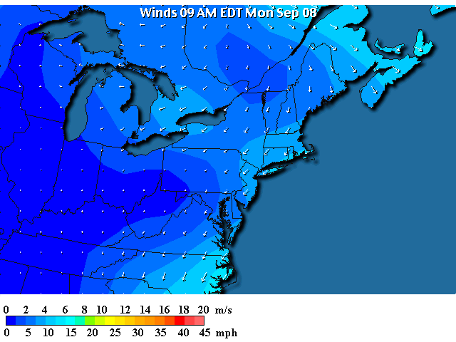
Winds this morning are out of the northeast and are fairly light.
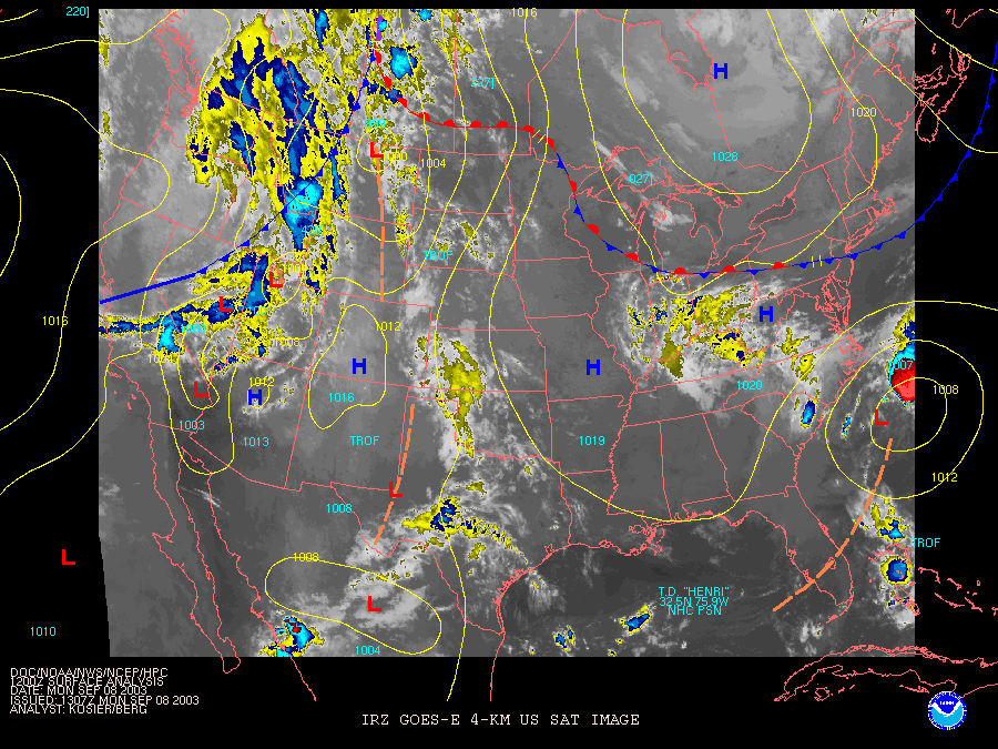
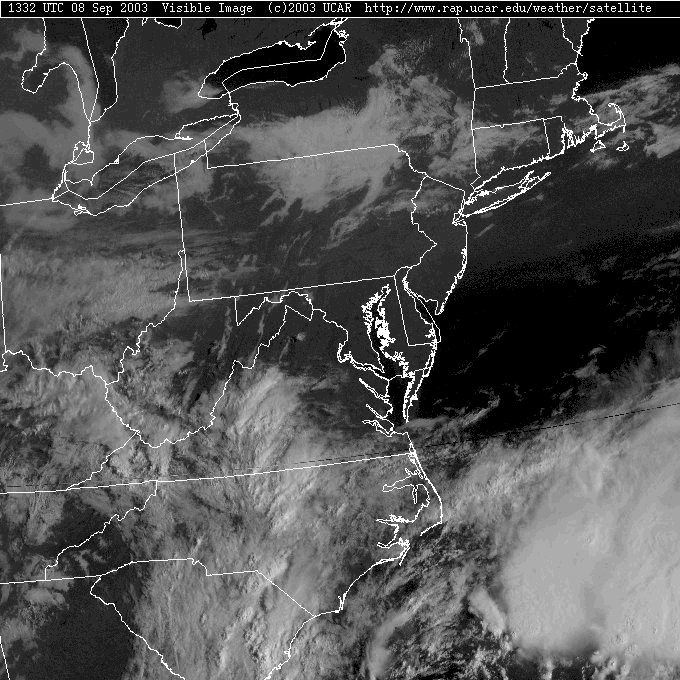
The visible satellite picture shows clouds over the northern parts of the state and then out in Ohio. Slightly brighter clouds with lumpy and fuzzy tops are visible down over the ocean to the distant south and southeast. The clouds over the ocean are from the convections inside Tropical Depression Henri. The clouds over northern PA might be anything EXCEPT if you look closely, you'll see they conform to the canyons and valleys in the land. That is one of our only hints those might be low clouds. What about the Ohio clouds are they convection like Henri or low clouds like those in our state?
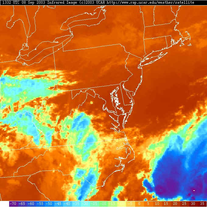
To answer that question we need to look at the Infrared satellite view. This shows temperature and nothing else. BUT clouds, the higher they are the more so, are colder than the ground - usually. The clear ground in this image (and ocean) is colored orange/red. The high and cold clouds are blue. The thunderstorms over Henri are very cold - so these are strong storms. The low clouds (and fog) in Pennsylvania are almost exactly the same temperature of the ground. The Ohio clouds are in the middle ground. They may only be cirrus moving in. To finally decide if they are storms, we need to look at the radar.
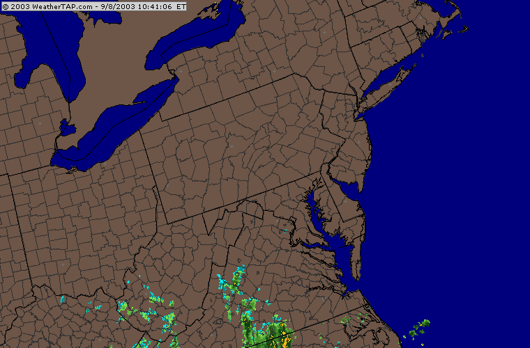
The radar shows, indeed, there is no precipitation falling out west. Those clouds are just high clouds moving along in the upper air flow.
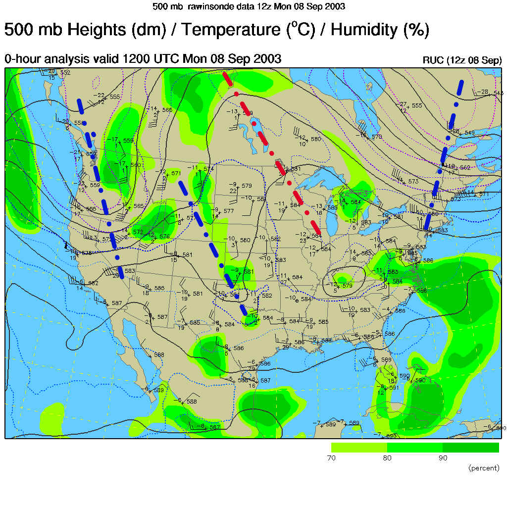
That upper air flow is seen well by looking at the 500mb map. This is the 'half pressure' map since we are seeing how high you need to go into the sky to get to the, roughly, one half surface pressure level. Winds blow mainly from west to east across the nation at this height (about 18,000 feet) and forms big troughs and ridges. The troughs are marked in blue and the ridges are marked in red. We often see thunderstorms and rain on the right side of troughs, and very good weather on the right side of a ridge (most of the time.
We are on the right side of the big ridge over the central part of the nation... so our weather is good.
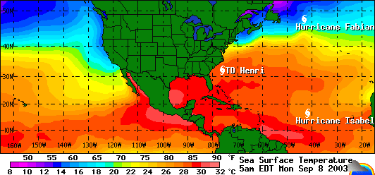
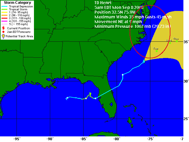
But the fun story involves (as I've said for the last week) the tropics. There are three named storms out there right now. But Henri is the main concern for us.
The National Hurricane Center is predicting the storm to arc eastward this week, but forecasters and at least a couple computer models are hinting that it may take a more coastal path (the red circle). If it stays near the coast, then we may get a LOT of water come the end of the week (this is a change from last week when I called for the rain to hit mid-week. It is going to move SLOWLY!).
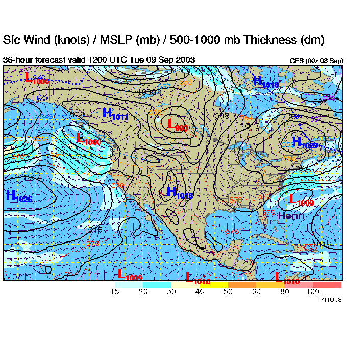
Let's watch what the GFS computer model is predicting... Tuesday morning Henri is east of Georgia.
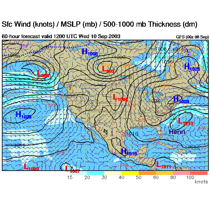
Wednesday morning, it has moved little.
Thursday morning it is a bit further off the coast, but we are now getting a good onshore flow pushing moisture inland.
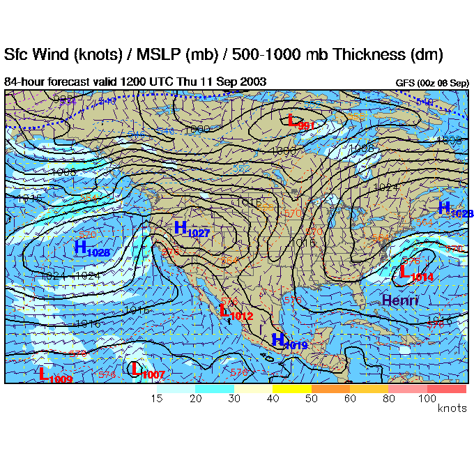
Friday morning, it's deeper and a bit further north.
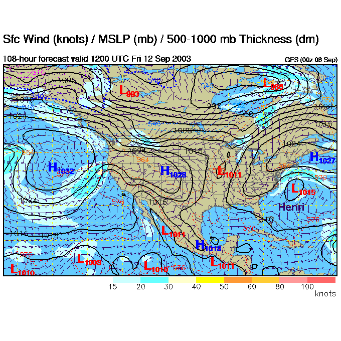
Saturday morning its coming up to our latitude out to sea. And we have onshore flow.
You can see Hurricane Isabel entering stage right.
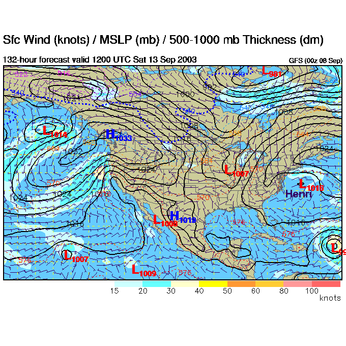
Then Sunday AM has it backed up a bit towards us! Will this happen? Hmmmm.
Isabel is still marching towards Florida and/or the Gulf of Mexico.
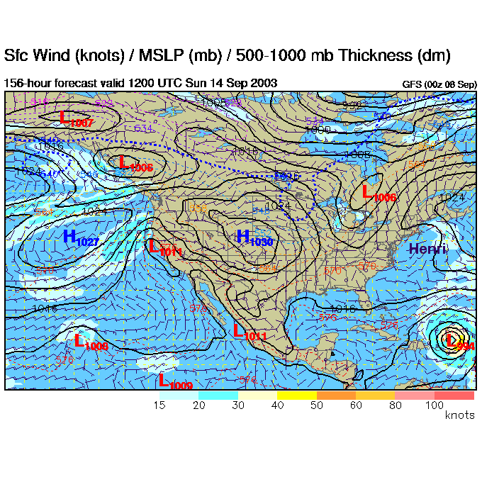
So we'll see what will happen. Tomorrow's computer runs may help clear up the waters a bit.
In the near future for us, we'll still have cool onshore flow and maybe a chance of showers in the mountains out west as this moist marine air is lifted up as it travels westward across Pennsylvania.
Tuesday night and there is a bit more convection happening out west, and the moisture from Henri starts spreading into Virginia and the Carolinas to the south.
This is a fascinating pattern to watch. Stick with these discussions and you'll learn the meteorological goings on behind an unusual weather situation.
Meteorologist John Ensworth
Surface Station sky cover color key:
Flight category definitions:| Category | Ceiling | Visibility | |
|---|---|---|---|
| Low Instrument Flight Rules LIFR* (magenta circle) |
below 500 feet AGL | and/or | less than 1 mile |
| Instrument Flight Rules IFR (red circle) |
500 to below 1,000 feet AGL | and/or | 1 mile to less than 3 miles |
| Marginal Visual Flight Rules MVFR (blue circle) |
1,000 to 3,000 feet AGL | and/or | 3 to 5 miles |
| Visual Flight Rules VFR+ (green circle) |
greater than 3,000 feet AGL | and | greater than 5 miles |
| *By definition, IFR is ceiling less than 1,000 feet
AGL and/or visibility less than 3 miles while LIFR
is a sub-category of IFR. +By definition, VFR is ceiling greater than or equal to 1,000 feet AGL and visibility greater than or equal to 3 miles while MVFR is a sub-category of VFR. |
|||