Back To Home
The Story Behind the Weather - By Forecaster John
Ensworth M.S. -
The Discussion of Weather Events Daily for Philadelphia and Pennsylvania
Last updated: 10/29/2003 10:16 AM
Good Morning Philadelphia!
I'm glad to announce that these discussions will continue until at least the end of November.
Today's discussion starts AGAIN with a look at the rain that has come and gone...
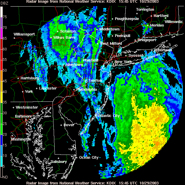
This is a current radar picture for the Philadelphia area...you can see what looks like the last of the showers pulling out to the northeast.
On the big picture, though, there are still some very light showers yet to move through out west. This is atmosphere and moisture that is being lifted by the actual next fronts' approach.

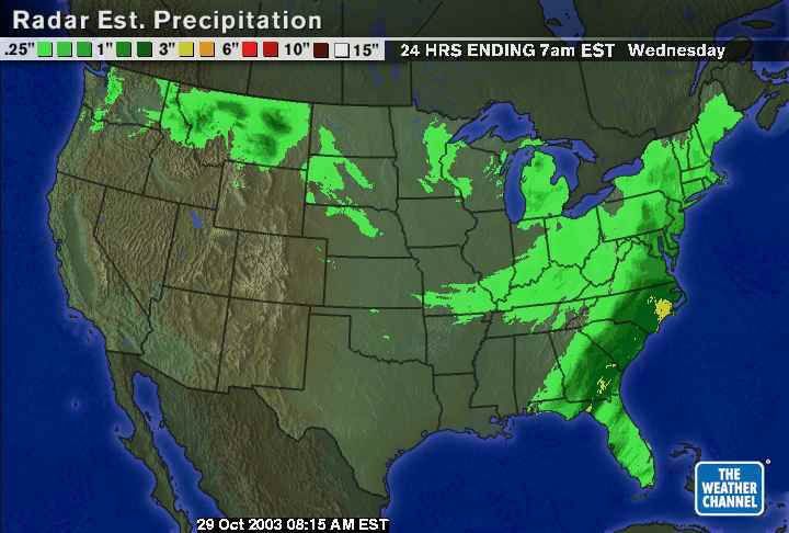
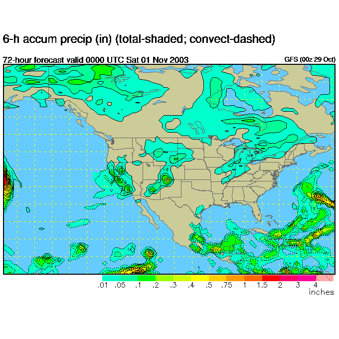
Over the last 24 hours, areas south of Philadelphia, near yesterday's stalled front, received the big rain, but we pushed an inch or so in southeast Pennsylvania.
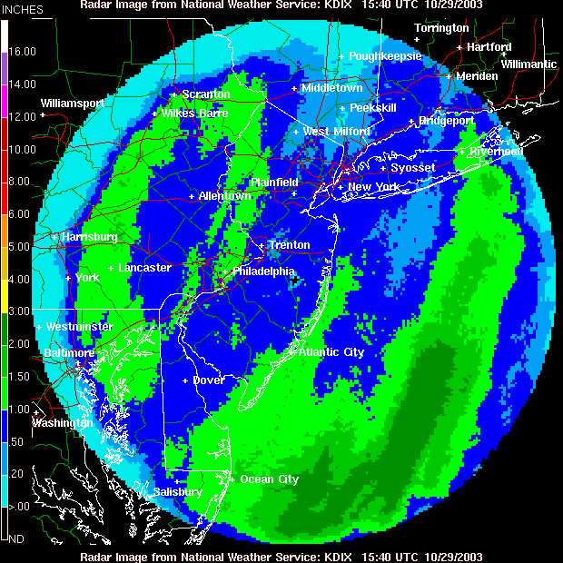
Locally, you can see a few swaths of 1" rain inland, and heavier amounts out over the sea.
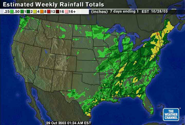
Looking at the week in total, you can see a large amount of Pennsylvania was hit with more than an inch, with much of eastern Pennsylvania up around 4" !!!
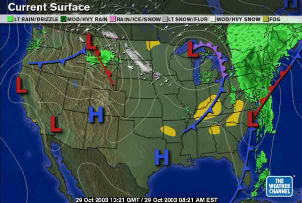
There goes the system (with an older radar image behind it) pulling slowly to the northeast (the low in North Carolina should roughly track along the front to the northeast of it). The colder air behind the front over the lakes will push eastward towards us, we'll cool briefly, then the warm air from the building east coast ridge will begin to warm us up quickly (See Yesterdays Discussion).
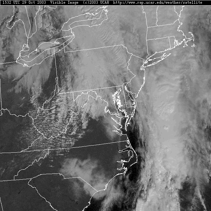
The clouds are still thick over all but extreme western Pennsylvania. But on this visible satellite picture, can you tell where the strongest storms are? (Well, you CAN see some bubbling tops along the band of clouds up the ocean off the coast).
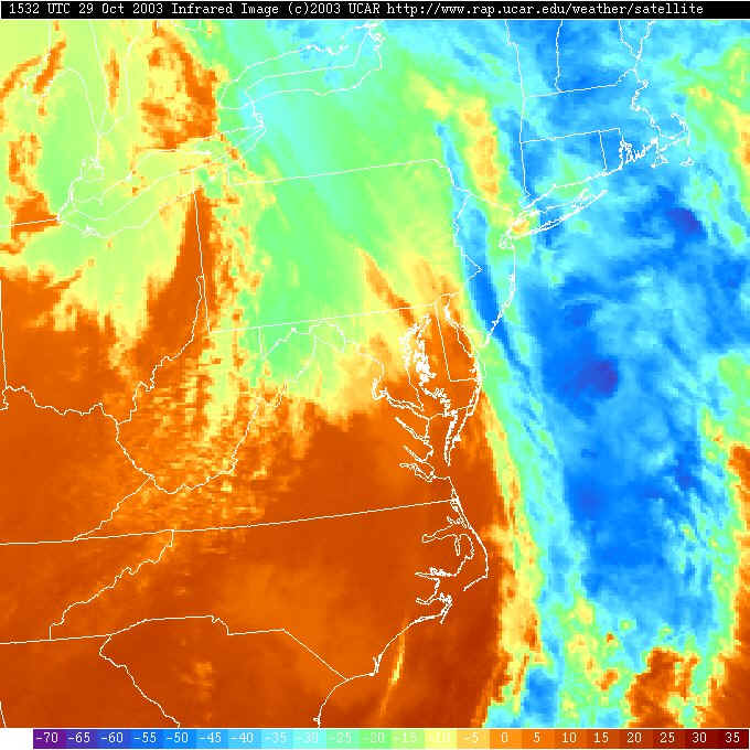
So the Infrared Satellite view shows us the temperatures of the cloud tops or ground (whichever the satellite can 'see'). The band of clouds off the coast have the highest and coldest cloud tops (blues). There is where the strongest convection (thunderstorms/rain) is happening. The stuff kicking off ahead of the front in coming out of the Great Lakes are NOT as strong (and do not have as cold cloud tops).
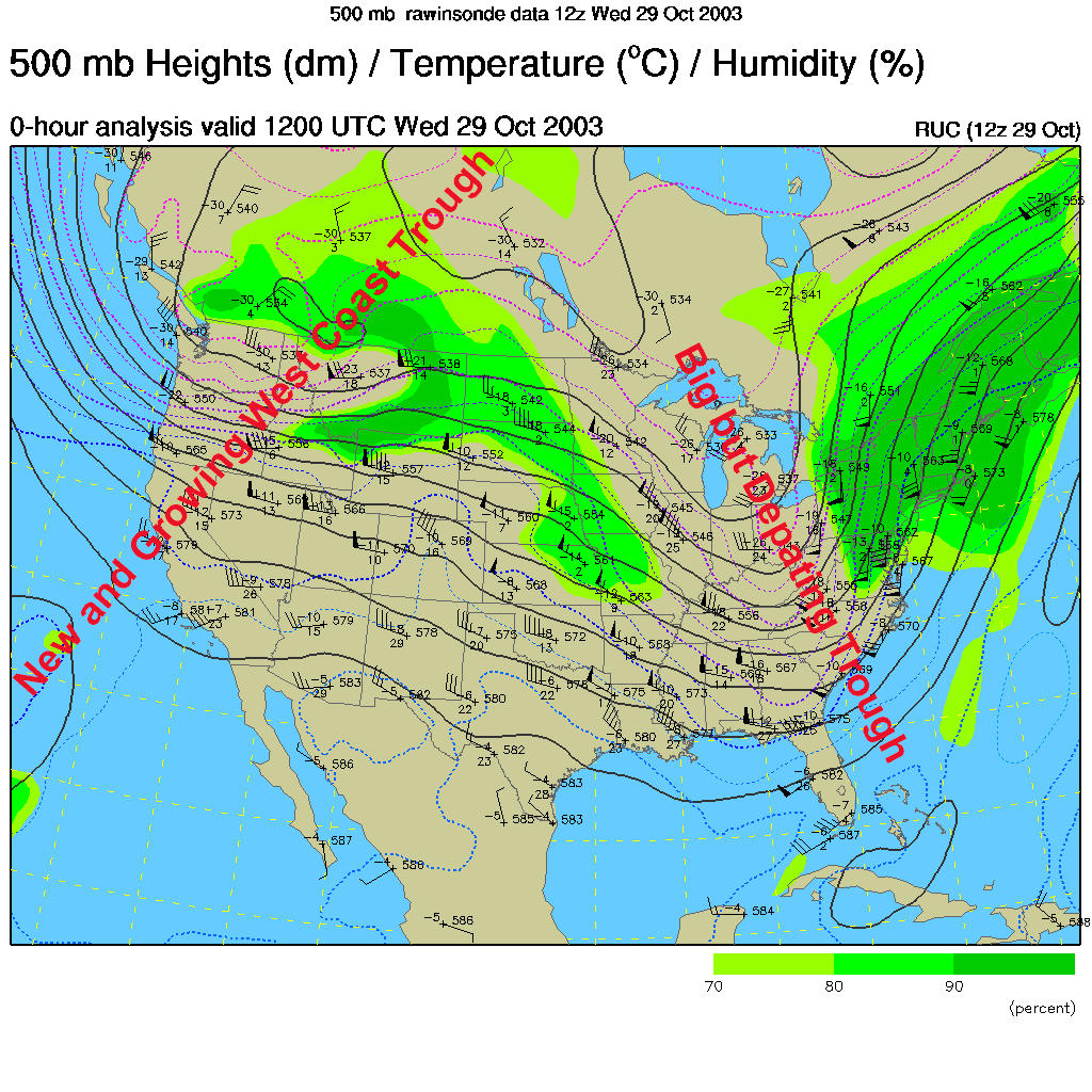
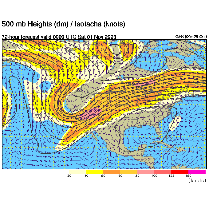
Take a look at the 500mb map below. This map shows the winds at about 18,000feet above sea level where winds 'steer' much of the surface features we see on the weather map. We have had a trough on the east coast almost since these discussions began in May. NOW the "Big but departing trough" will be replaced with a high pressure ridge through the beginning of next week. Out on the west coast a NEW trough is digging in for a bit (which will change the weather patterns that set up the fires in S. California).
By Friday night, the trough dominates on the West coast in the upper air flow, and we have a broad flat ridge over our heads (big warm-up! and dry weather!). (For a more detailed handling of the week ahead, see yesterday's discussion).
Showers hit California, but not Pennsylvania Friday night.
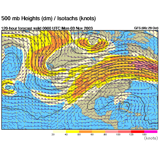
Then leaping to Sunday night, the ridge is STILL massively huge over the east coast and a new lobe swings into the trough on the west coast, keeping it alive.
Stay warm and wait for the sun, it is returning (well, even with the sunspots and all). I'll see you again Thursday morning.
Meteorologist John Ensworth
Surface Station sky cover color key:
Flight category definitions:| Category | Ceiling | Visibility | |
|---|---|---|---|
| Low Instrument Flight Rules LIFR* (magenta circle) |
below 500 feet AGL | and/or | less than 1 mile |
| Instrument Flight Rules IFR (red circle) |
500 to below 1,000 feet AGL | and/or | 1 mile to less than 3 miles |
| Marginal Visual Flight Rules MVFR (blue circle) |
1,000 to 3,000 feet AGL | and/or | 3 to 5 miles |
| Visual Flight Rules VFR+ (green circle) |
greater than 3,000 feet AGL | and | greater than 5 miles |
| *By definition, IFR is ceiling less than 1,000 feet
AGL and/or visibility less than 3 miles while LIFR
is a sub-category of IFR. +By definition, VFR is ceiling greater than or equal to 1,000 feet AGL and visibility greater than or equal to 3 miles while MVFR is a sub-category of VFR. |
|||