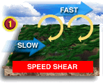
 ] Everywhere the wind
rises on one of those rolls, you get a lane of clouds!
] Everywhere the wind
rises on one of those rolls, you get a lane of clouds!Back To Home
The Story Behind the Weather - By Forecaster John
Ensworth M.S. -
The Discussion of Weather Events Daily for Philadelphia and Pennsylvania
Last updated: 11/29/2003 10:11 AM
Good Morning Philadelphia!
I'm glad to announce that these
discussions will continue until at least the end of
this Year!.
I
have the necessary server space.
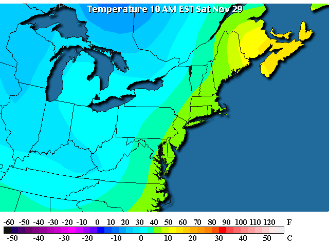
In short: High temperatures will hover in the mid to upper 40's for the next week (we may see 50 to 52 or so, but only in the afternoon) and we will see a couple of chances for snow flurries in the air. Yes, winter is here now that Thanksgiving is past.
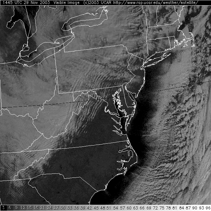
We have overcast skies this morning (well, I've seen a few blue breaks) but the clouds are not completely filled in over the southeast part of the state. The clouds ARE thicker out west and the horizontal rolls of the air I spoke of in an earlier discussion are evident on the visible satellite picture below. [Air near the surface is calmer than air aloft, so you get horizontal rolls - as seen in the small inset image here:
] Everywhere the wind
rises on one of those rolls, you get a lane of clouds!
Under these clouds, we are getting light precipitation. It also has a flimsy look on radar. Might it be like yesterday's radar? It is lake effect again... winds are blowing across the lakes from the northwest and are picking up moisture from the relatively warm water and lifting it into clouds and precipitation formation.
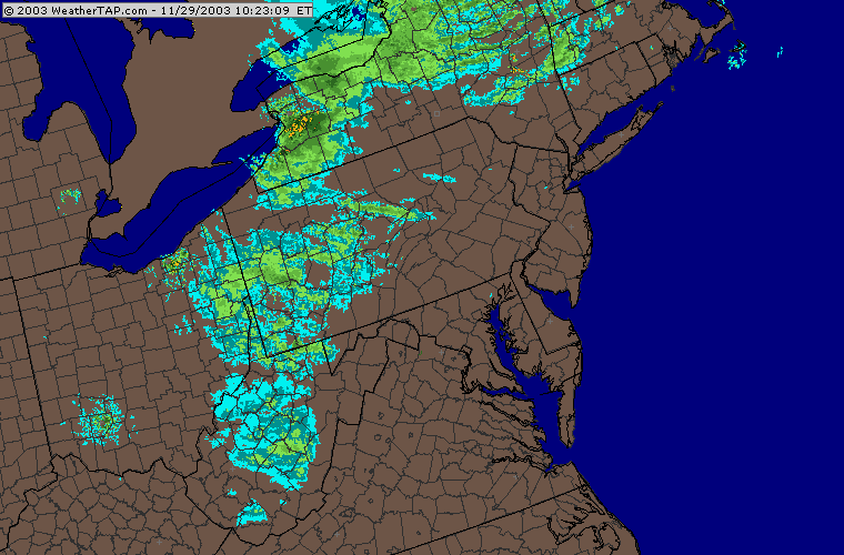
And YES! On the radar the flimsy look IS snow again. It is cold enough out west for the precipitation that is falling to be in the form of snow, not heavy snow, but snow.
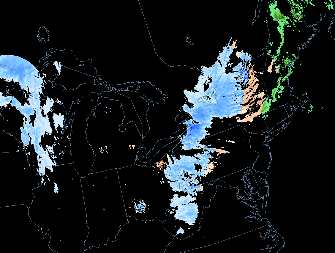
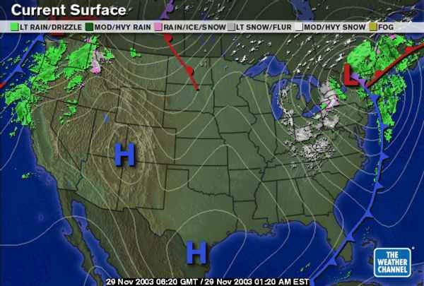
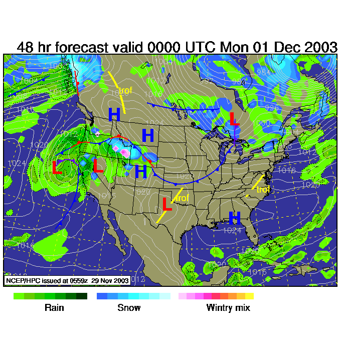
The surface map shows these 'wrap around (the low)' lake effect snows and the departing big front.
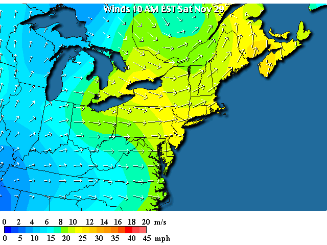
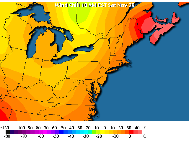
Winds (as advertised yesterday) are very notable. We have winds near 20mph with gusts as high as 45mph possible today. With cold temperatures and strong winds, this must mean...
...with temperatures in the 30's ...
We need to be aware of the wind chill. We are hovering in the upper 20's this morning. Brrr.
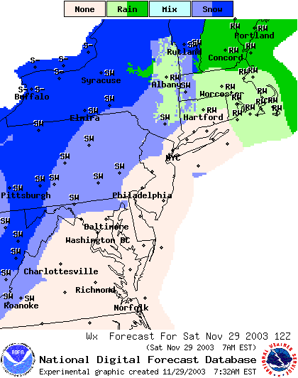
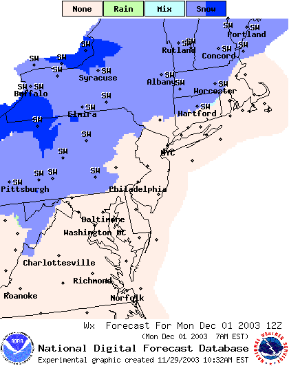
So the National Weather Service has a chance of snow showers almost INTO the city today as temperatures stay low and the lake effect waves keep sliding out to the east. Will you see any snow? Only if you go out and stare at the atmosphere for a while...you might catch some flakes, especially before the temperatures get closer to the 40's this afternoon. (This map is for today at 7am - past!).
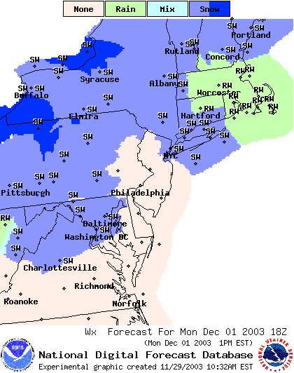
By 1pm we still have a chance of snow showers...
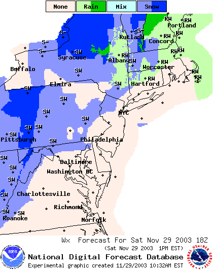
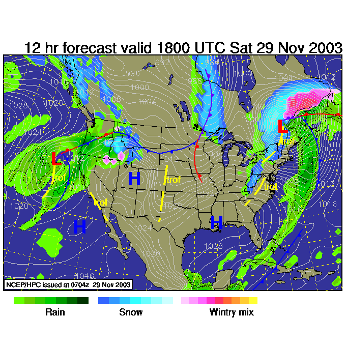
So by 1pm today, the snow showers and even some snow changing back to rain will be falling out in western Pennsylvania. The Low pressure center will still be keeping a tight pressure gradient over the region (the white lines of equal pressure will be very close together, this bunching shows you where the strong winds are blowing) so it will remain windy.
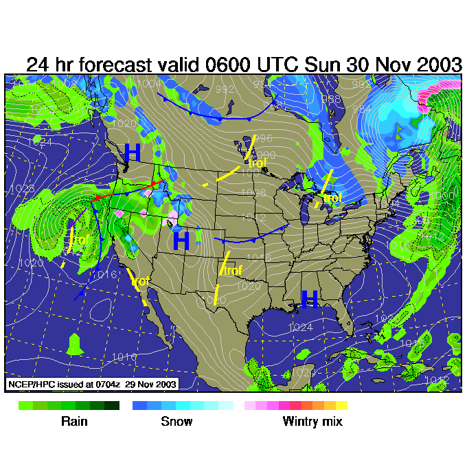
By 1am Sunday, the Low has pulled off to the northeast and the pressure gradient relaxes. The snows stop out west and the wind dies down. But it does stay cold.
Sunday night 7pm, we are between systems and have nothing but chilly air in place.
Hoping for snow, I'll now take you out to Monday morning - 7am - as the next front approaches. We see another chance of light snow approach the city (20% chance of precipitation, not much to get excited about).
Then for 1pm Monday, we see the slight chance snow continue.
Here's hopin' for snow. Stay out of the wind today and stay warm.
AND if you are ambitious, watch the skies for the magical flake or two that says Santa is comin'!
Meteorologist John Ensworth
Surface Station sky cover color key:
Flight category definitions:| Category | Ceiling | Visibility | |
|---|---|---|---|
| Low Instrument Flight Rules LIFR* (magenta circle) |
below 500 feet AGL | and/or | less than 1 mile |
| Instrument Flight Rules IFR (red circle) |
500 to below 1,000 feet AGL | and/or | 1 mile to less than 3 miles |
| Marginal Visual Flight Rules MVFR (blue circle) |
1,000 to 3,000 feet AGL | and/or | 3 to 5 miles |
| Visual Flight Rules VFR+ (green circle) |
greater than 3,000 feet AGL | and | greater than 5 miles |
| *By definition, IFR is ceiling less than 1,000 feet
AGL and/or visibility less than 3 miles while LIFR
is a sub-category of IFR. +By definition, VFR is ceiling greater than or equal to 1,000 feet AGL and visibility greater than or equal to 3 miles while MVFR is a sub-category of VFR. |
|||