Back To Home
The Story Behind the Weather - By Forecaster John
Ensworth M.S. -
The Discussion of Weather Events Daily for Philadelphia and Pennsylvania
last updated: 09/14/2003 02:19 PM
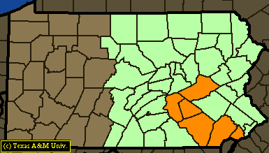
Water water everywhere... and you can drop and drink it if you like (it might help the flooding!). We have a continued flash flood watch for the eastern about one half of the state with new counties near (just to the west of) us in PHiladelphia.
![]()
![]()
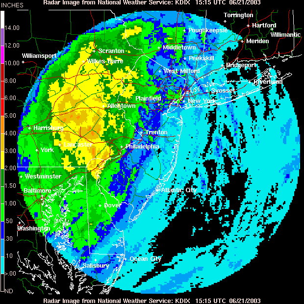
The Doppler Radar rainfall total map shows very significant amounts of accumulated rainfall over the warning areas. Rainfall amounts of greater than two inches have fallen. You can see the lesser amount of rainfall over the ocean. What is happening is the onshore flow is getting lifted up onto the land (higher elevations) and is cooling as it rises. Moist air that is lifted for any reason makes clouds and rain.
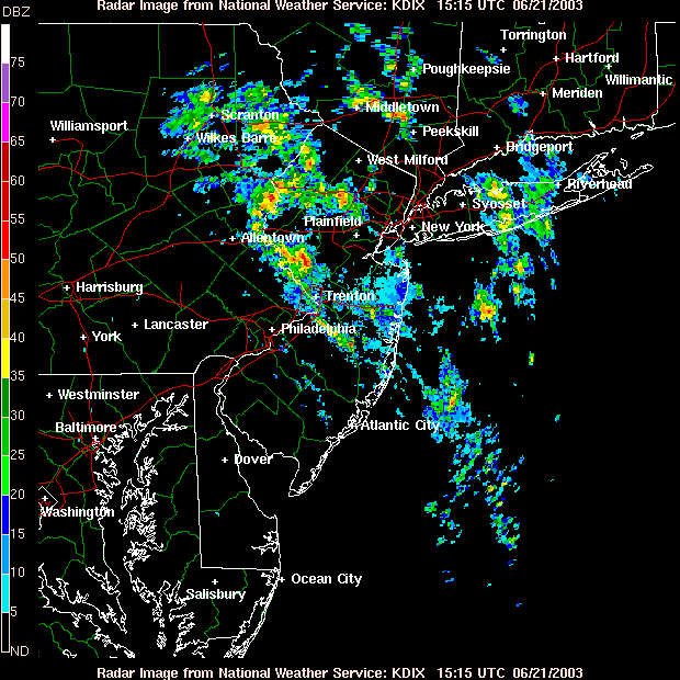
At midday today, we are getting a bit of a break. Showers and thunderstorms are located to our northeast. But be warned, according to some computer models, places across eastern PA and NY state may get 2-5 inches of rain before this last system pulls away to the east. It *may* be us, or it *may* not. That is below the resolution of the computer models involved - unfortunately.
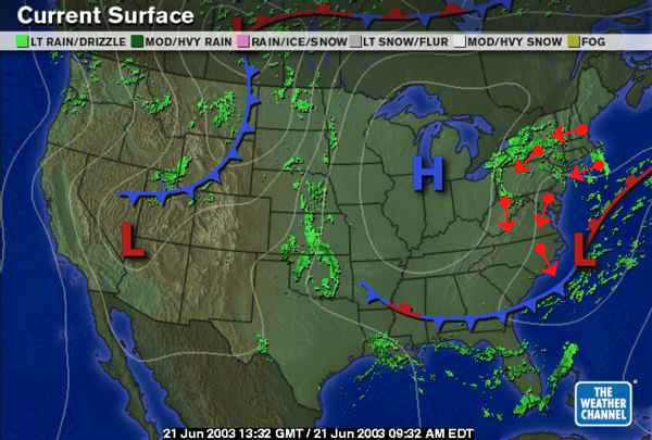
Looking at the surface map, the low that formed on the front (see yesterday's discussion) actually formed. It is pumping the air off the ocean over our heads (see the red arrows showing the counterclockwise air flow around the low).
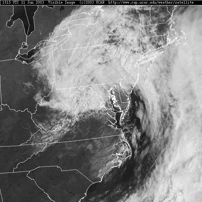
The visible satellite picture shows the clouds (as it seems) targeting Pennsylvania. It IS clear elsewhere (west, and south). Remember, the visible satellite shows you the view (in black and white) that you would see with your eyes. White things are bright (i.e. clouds), and dark things are dark (i.e. the lakes to the west and ocean to the east).
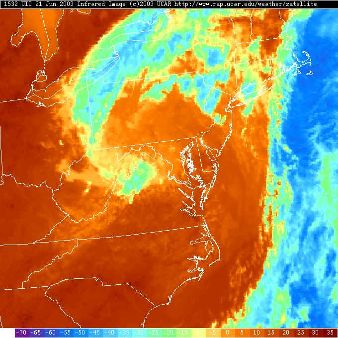
The Infrared Satellite (which shows temperature visually - blues are very cold ice clouds, and reds are warm bare ground) shows the cool air and clouds over us (oranges/yellows) and the bands of higher clouds resulting in the rainfall to the northeast of the city. You are used to this view, but the next image is new to you...
This satellite image is the Water Vapor image. It is looking at a frequency of microwaves given off by water vapor in the middle part of the troposphere (the troposphere is the lower layer of the atmosphere up to about 30,000 feet, where all the weather happens). The purples are very moist, the blacks are dry in the atmosphere, and the reds are extremely dry in the middle atmosphere. You are not seeing the surface (really) in these pictures even though the geographic and political boundaries are illustrated.
By looking at the purples and blues off the east coast,
you can see the tropical moisture that has been pulled up ahead of this
system. From this you can see the place to the northeast of us where the
moisture is feeding westward into the cold pool of air aloft to swirl over our
heads. Without this upper level swirl (low) we wouldn't worry about the
system off the coast at all. But, instead, we are getting an ongoing
chance of rain. 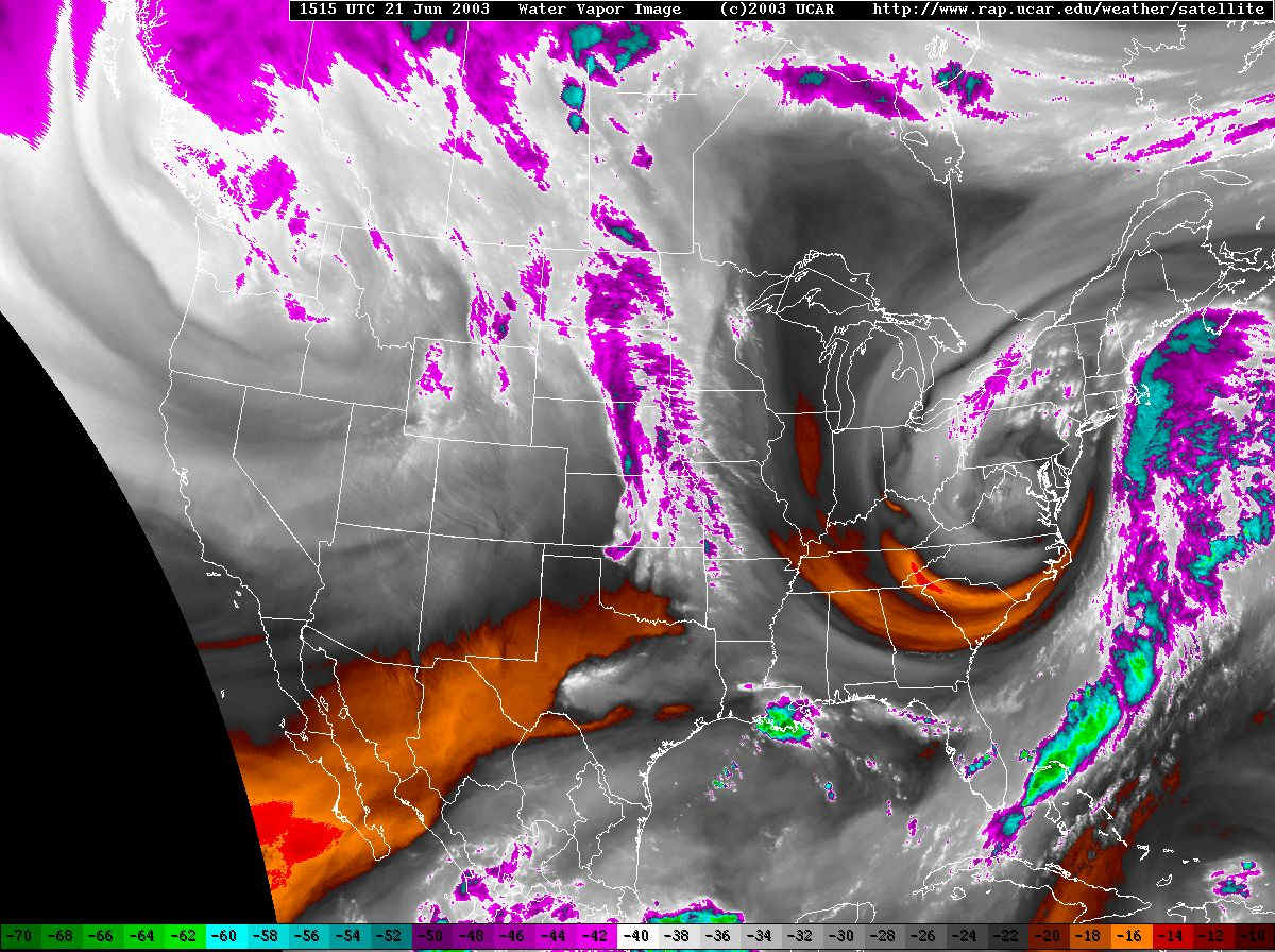
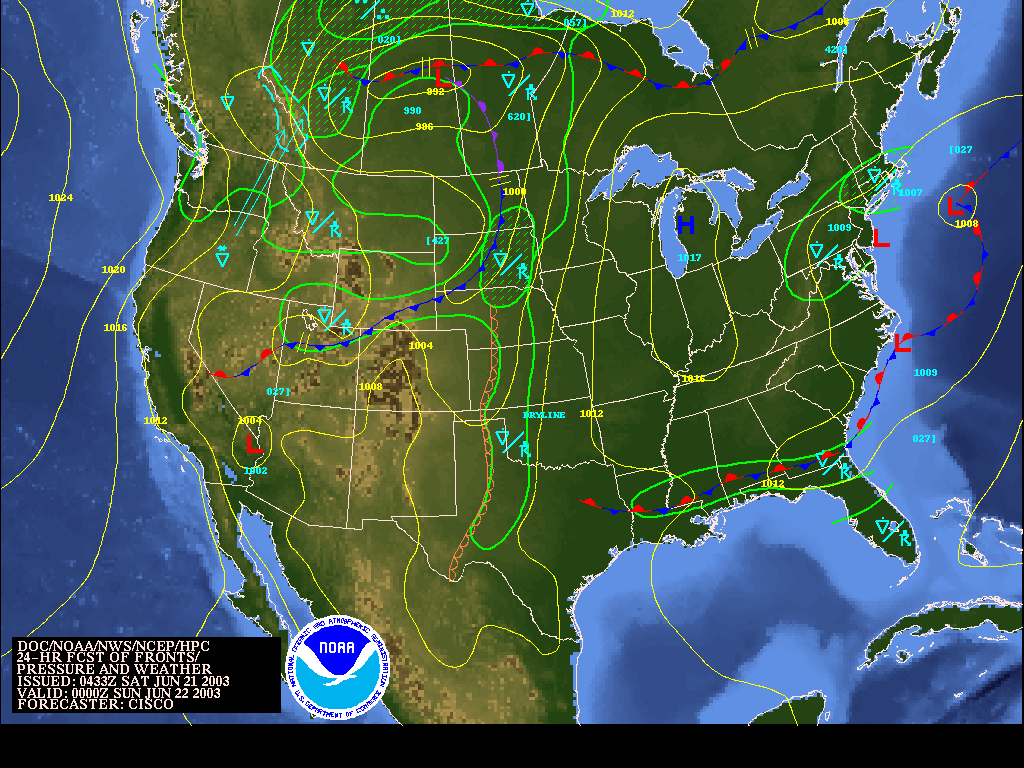
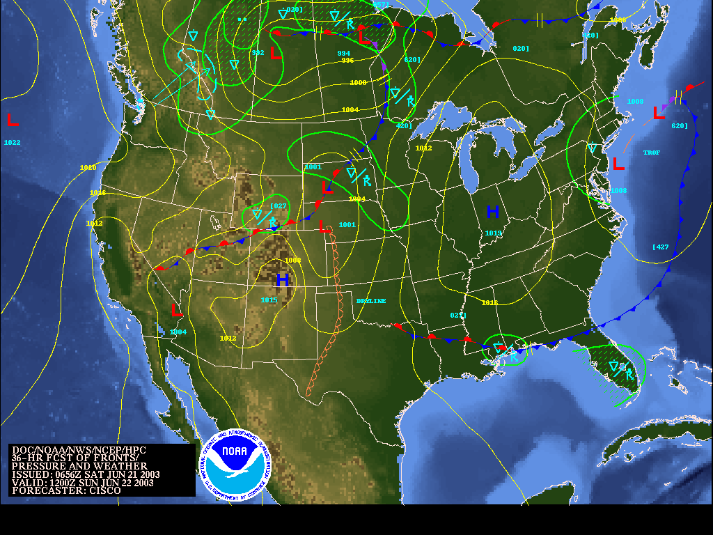
Looking at the surface maps of the future, you can see the end of the current system coming on Sunday. There is a new surface low forming just off the coast to our east by tonight 8pm - feeding more moisture in and helping air to rise and make rain for us. You can see the heaviest rain forecast to be to the northeast of the state.
By tomorrow morning 8am, there are still showers kicking around to the west of the Low over the eastern half of the state.
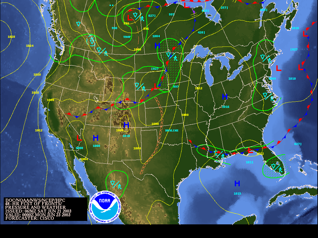
By Sunday 8pm, there is still a low out over the ocean bringing showers around it's west side to us, but the front is even farther away. After this... head and dryness is coming!
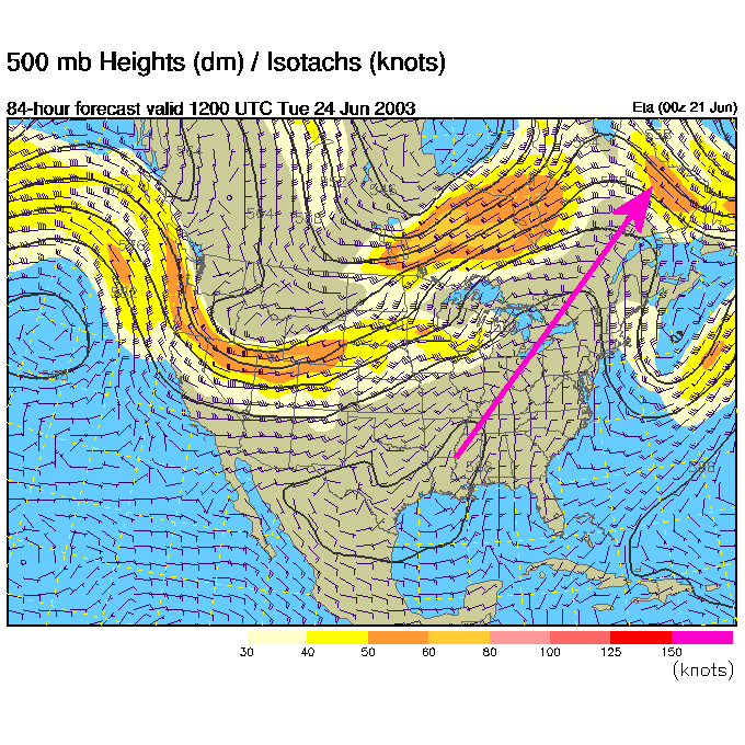
Look for temperatures to rapidly become summer like after this. The 500mb forecast for Tuesday morning shows a big ridge (the axis is marked with a big purple arrow) sliding in over the area. Temperatures should easily approach the 90's. With all the water in the ground and plants, we shouldn't see mid 90's or higher often, but it could have happened if the drought was still going. Instead it will be hot and VERY humid!
In the mean time-
Stay dry,
Meteorologist John Ensworth
Surface Station sky cover color key:
Flight category definitions:| Category | Ceiling | Visibility | |
|---|---|---|---|
| Low Instrument Flight Rules LIFR* (magenta circle) |
below 500 feet AGL | and/or | less than 1 mile |
| Instrument Flight Rules IFR (red circle) |
500 to below 1,000 feet AGL | and/or | 1 mile to less than 3 miles |
| Marginal Visual Flight Rules MVFR (blue circle) |
1,000 to 3,000 feet AGL | and/or | 3 to 5 miles |
| Visual Flight Rules VFR+ (green circle) |
greater than 3,000 feet AGL | and | greater than 5 miles |
| *By definition, IFR is ceiling less than 1,000 feet
AGL and/or visibility less than 3 miles while LIFR
is a sub-category of IFR. +By definition, VFR is ceiling greater than or equal to 1,000 feet AGL and visibility greater than or equal to 3 miles while MVFR is a sub-category of VFR. |
|||