Back To Home
The Story Behind the Weather - By Forecaster John
Ensworth M.S. -
The Discussion of Weather Events Daily for Philadelphia and Pennsylvania
Last updated: 09/14/2003 02:34 PM
Good Morning Philadelphia!
To get the most out of today's discussion, I encourage you to read the more complete (extremely complete some might say) discussion from yesterday. The whole story is the squeeze between a low and a high. Let's go see what they are doing today...
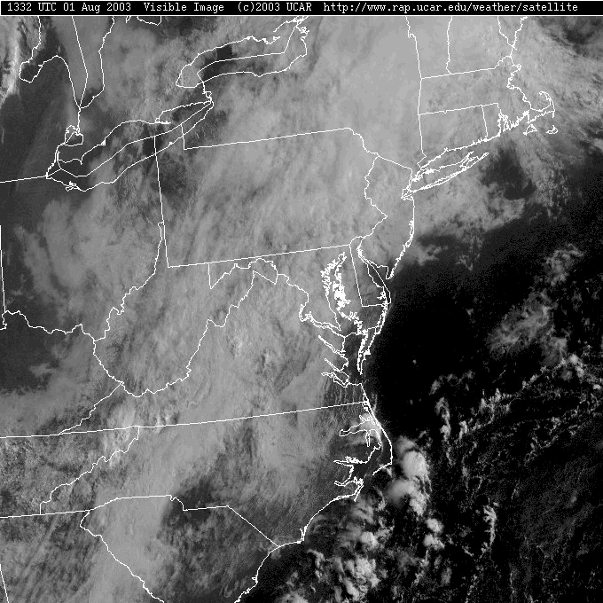
Looking out the window, you see ... CLOUDS! Thick lower and upper level clouds dominate the whole region as the weather system squeeze gets applied. This should be the norm for much of the upcoming week.
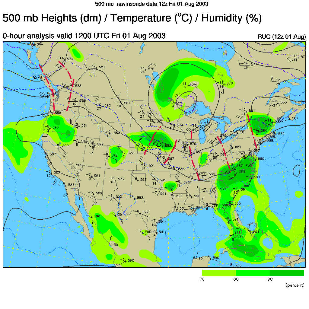
The Infrared satellite view, which shows temperature (reds = warm, usually the ground or open ocean, greens/blues = very cold, usually high ice clouds), shows the swath of high clouds streaming over head.
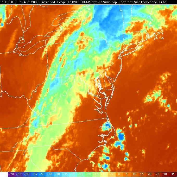
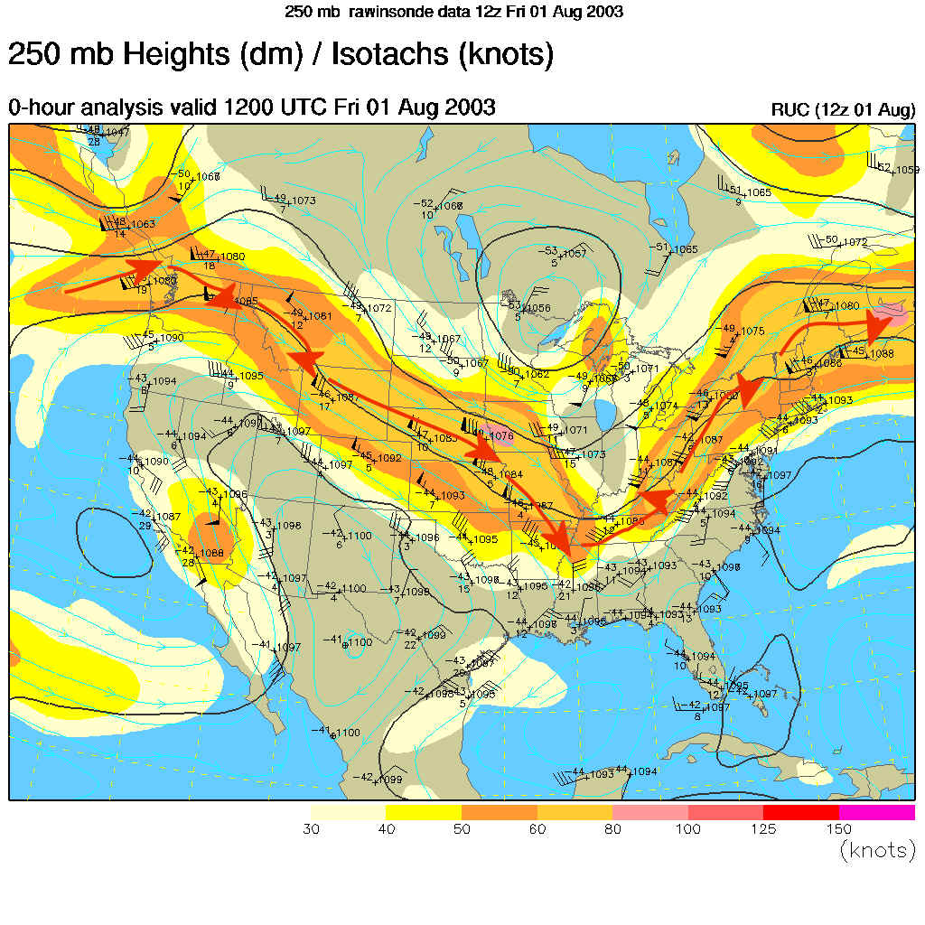
These high clouds match well with the position of the jet stream traced in red arrows and the bright colors on the map below. This map shows the winds blowing at 250mb or about 30,000 feet above sea level. The winds blow in the direction from the triangular flags to the points on the arrows you see in the map below. The triangles are 50knot winds, the full barbs are 10 knots, the half barbs are 5knots. You can add the triangles, barbs and half barbs like roman numerals. (For example, a triangle and a half barb is 55knots). A knot is very close to a mile per hour.
There are rain showers to our north moving away. We just have clouds this morning near Philadelphia...
Looking around the region, we have nothing immediately upstream, but with the passage of short waves (cool bubbles of upper air - see below) and day time heating this afternoon... we'll see storms and showers fire up all over the place.
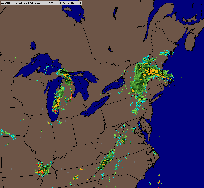
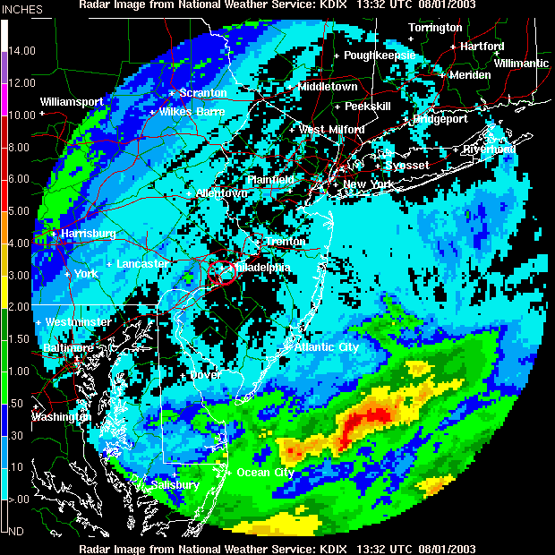
The last day saw rain to our northwest and southeast. We are in a gap between the places where showers hit. With the expected amounts of rain that may fall over the next 4-5 days, I say let the rain hold off as long as possible (more on that below).
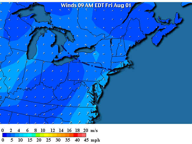
The winds at the surface across Pennsylvania are coming from the southeast, north of the black dotted /dashed line the winds are from the east. The front has moved to the north again. We are now beginning to get the warm tropical air and highly humid sticky air.
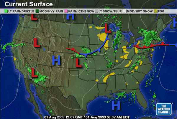
The surface map shows the warm front to the north and areas of fog around the Appalachians north and south.
The above mentioned short waves (bubbles of cool air aloft that can help trigger showers and storms) are marked in red on this map. They are pretty minor, but as the moisture pours northward across the eastern US, there will be ample fuel for showers and rain.
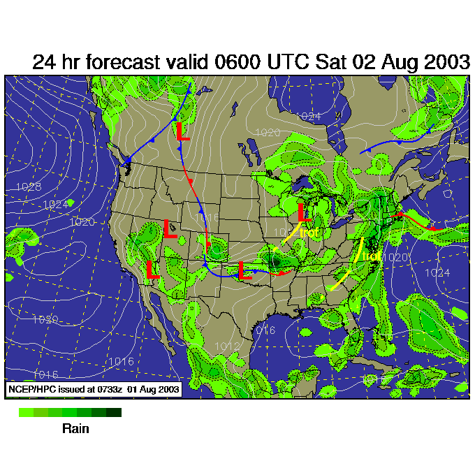
So looking forward to early Saturday morning (2am), we see the front just a bit further north (and washing out) and rain spreading over the area...
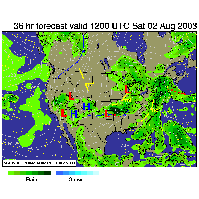
Saturday morning 8am, more rain!
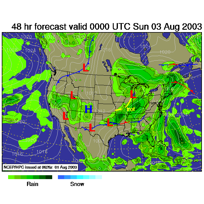
Saturday night, more rain, with a new system pushing itself out of the northern Ohio Valley towards us (with the next strong trough in the upper air pattern).
The flow of tropical moisture is expected to become quite impressive over the next 4-5 days. Thunderstorms will have the potential, in places, of dumping up to 2 inches an hour in rainfall. The National Weather Service is expecting as much as 2 FEET of rain will fall in locations around Pennsylvania!
I'll be back midday tomorrow to see how much water is coming down.
Until then, keep looking up!
Meteorologist John Ensworth
Surface Station sky cover color key:
Flight category definitions:| Category | Ceiling | Visibility | |
|---|---|---|---|
| Low Instrument Flight Rules LIFR* (magenta circle) |
below 500 feet AGL | and/or | less than 1 mile |
| Instrument Flight Rules IFR (red circle) |
500 to below 1,000 feet AGL | and/or | 1 mile to less than 3 miles |
| Marginal Visual Flight Rules MVFR (blue circle) |
1,000 to 3,000 feet AGL | and/or | 3 to 5 miles |
| Visual Flight Rules VFR+ (green circle) |
greater than 3,000 feet AGL | and | greater than 5 miles |
| *By definition, IFR is ceiling less than 1,000 feet
AGL and/or visibility less than 3 miles while LIFR
is a sub-category of IFR. +By definition, VFR is ceiling greater than or equal to 1,000 feet AGL and visibility greater than or equal to 3 miles while MVFR is a sub-category of VFR. |
|||